IMAGES TAKEN NEAR TO
Fairs Field, STEYNING, BN44 3BU

Introduction

This page details the photographs taken nearby to Fairs Field, BN44 3BU by members of the Geograph project.

The Geograph project started in 2005 with the aim of publishing, organising and preserving representative images for every square kilometre of Great Britain, Ireland and the Isle of Man.

There are currently over 7.5m images from over14,400 individuals and you can help contribute to the project by visiting https://www.geograph.org.uk

Image Map


Images are licensed for reuse under creativecommons.org/licenses/by-sa/2.0
Notes
  • Clicking on the map will re-center to the selected point.
  • The higher the marker number, the further away the image location is from the centre of the postcode.

Image Listing (243 Images Found)

Images are licensed for reuse under creativecommons.org/licenses/by-sa/2.0
  • ...
Image
Details
Distance
1
Fair Field, Steyning
A cul de sac off Charlton Street built around 2013-14 on the site of Briton's Croft, a former care home. The development is for over 55s only.
Image: © Simon Carey Taken: 15 May 2016
0.01 miles
2
Fire Station, High Street, Steyning
Opened in 1961 having previously been based in Image and before that Image
Image: © Simon Carey Taken: 29 May 2016
0.03 miles
3
Steyning fire station
Steyning fire station, High Street, Steyning, West Sussex
Image: © Kevin Hale Taken: 16 Jun 2007
0.03 miles
4
Mill Road, Steyning
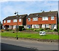
Red-brick terraced housing, dating - I would guess - from about 1900. At the northern end of the street there is indeed a mill - Court Mill, an old water mill now used as a private residence.
Image: © Stefan Czapski Taken: 25 Sep 2014
0.03 miles
5
Chanctonbury Cottage, High Street, Steyning
Only the thatched roof is visible of number 103 and is the only dwelling on the southern side of the High Street, along with Image to be built some distance back from the road. Originally a medieval hall house.
Image: © Simon Carey Taken: 29 May 2016
0.03 miles
6
SME Ltd, Charlton Street, Steyning
A small factory located on the corner of Mill Road that was purpose built in 1961 for the company who specialise in gramophone turntables and arms.
Image: © Simon Carey Taken: 15 May 2016
0.04 miles
7
Iris Cottages, Charlton Street, Steyning
A pair of cottages built around 2009.
Image: © Simon Carey Taken: 15 May 2016
0.04 miles
8
111-117, High Street, Steyning
A pair of semi-detached houses located between Image and St George's Place that were built in the 1960s on a former field called Briton's Croft, according to Steyning's 1841 tithe map.
Image: © Simon Carey Taken: 29 May 2016
0.05 miles
9
Footpath to High Street, Steyning
An old right of way linking High Street to Newham Lane via Charlton Street and Image On the left are Image built a few years ago on the site of 99-101 High Street who were located roughly where the car is. The cottages were named after 'ox kews' metal shoes for oxen which produced by a nearby smithy.
Image: © Simon Carey Taken: 5 Jun 2016
0.05 miles
10
Mill Road, Steyning
The southern side of the road that connects Charlton Street and St George's Place. The terrace was constructed in the first decade of the 20th century. In the distance is Image after which the road is named.
Image: © Simon Carey Taken: 15 May 2016
0.05 miles
  • ...