1
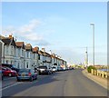
The A259 passes Kingston Lane at traffic lights
Image: © Shazz
Taken: 29 Aug 2016
0.02 miles
2
3-9, Albion Street, Southwick
Built in the first decade of the 20th century with numbers 7 and 9 on the right looking like they will follow 17-27 which were originally located beyond the blue fence prior to their demolition in 2018.
Image: © Simon Carey
Taken: 24 May 2020
0.03 miles
3
Kingston Beach
Looking towards the houses on Brighton Road, the A259, built in the 1860s.
Image: © Simon Carey
Taken: 1 Feb 2009
0.03 miles
4
Rail Bridge over Kingston Lane
Bridge carrying the West Coastway line between Southwick and Shoreham
Image: © Paul Gillett
Taken: 9 Jun 2015
0.03 miles
5
Old Boundary Marker by Kingston Lane, Shoreham-by-Sea Parish
Parish Boundary Marker by the UC road, in parish of Shoreham-By-Sea (Adur District), Kingston Lane, next to bridge on verge, South side of bridge, East side of road.
Surveyed
Milestone Society National ID: SX_KINSOW01pb
Image: © Milestone Society
Taken: Unknown
0.03 miles
6
Looking north through railway bridge on Kingston Lane
Image: © Shazz
Taken: 29 Aug 2016
0.04 miles
7
Old Warehouses, Albion Street, Southwick
The cobbled frontage dates back to the early 19th century whilst the roofing is modern. These and a few at Shoreham are all that remains of the small warehouses and workshops that lined the riverside during the 19th century. The road in the foreground is the A259.
Image: © Simon Carey
Taken: 24 May 2020
0.04 miles
8
Brighton Road, Kingston By Sea
The houses in view were built in the first decade of the 20th century and look out over Kingston Beach.
Image: © Simon Carey
Taken: 24 May 2020
0.04 miles
9
Kingston by Sea, railway bridge
Carrying the coastal railway route over Kingston Lane.
Image: © Mike Faherty
Taken: 7 Apr 2018
0.04 miles
10
Old Warehouses, Albion Street
A mixture actually, the cobbled frontage dates back to the early 19th century whilst the roofing is modern. These and a few at Shoreham are all that remains of the small warehouses and workshops that lined the riverside during the 19th century. The road in the foreground is the A259.
Image: © Simon Carey
Taken: 1 Feb 2009
0.05 miles


