1
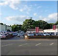
Kingston Wharf
Formerly occupied by Stamco but now being cleared as all the six wharves along the northern side of the western arm of Shoreham Harbour are being redeeveloped for housing.
Image: © Simon Carey
Taken: 24 May 2020
0.01 miles
2
Kingston Wharf
On the northern bank of the western arm of Shoreham Harbour. The planks have been collected from local beaches and are the former cargo of the 'Ice Prince' which sank off Devon in January. Beyond them are warehouses on Brighton Road with the outline of the Downs just visible over the roofs.
Image: © Simon Carey
Taken: 26 Feb 2008
0.02 miles
3
Day Aggregates. Shoreham Depot, Brighton Road
Image: © Richard Cooke
Taken: 5 Jun 2018
0.03 miles
4
Former R.N.L.I. Lifeboat "Lloyds", at Shoreham Harbour, Sussex
Here's a rare "spot" which I would not have seen, had I not been on foot. Currently on a derelict piece of land, overlooking Shoreham Harbour, and awaiting restoration. "Lloyds" is a 51 foot Barnett/Stromness type, built in 1932.
http://www.nelsonsboats.co.uk/ListBoats.html
Image: © Peter Trimming
Taken: 17 Apr 2010
0.03 miles
5
Malthouse Industrial Estate, Brighton Road
As the name suggests these warehouses lining the A259 were built on the site of a former malthouse which operated from 1844 until its closure in 1969. The buildings were demolished in 1971 along with the former bridge that carried the road over railway sidings servicing Kingston Wharf.
Image: © Simon Carey
Taken: 1 Feb 2009
0.03 miles
6
Kingston by Sea, Stamco
Building supplies store on Brighton Road.
Image: © Mike Faherty
Taken: 7 Apr 2018
0.03 miles
7
Kingston Wharf
This is the eastern end of the wharf now used by timber wholesalers, Stamco but only the land not the actual wharf itself. Taken from the gate on the A259 with Shoreham Beach across the west arm of the harbour.
Image: © Simon Carey
Taken: 1 Feb 2009
0.04 miles
8
Royal Rebel
Fishing vessel Royal Rebel (reg SM3) entering Shoreham Harbour.
Image: © Ian Capper
Taken: 17 Mar 2022
0.04 miles
9
Lighthouse Car Centre, Brighton Road, Shoreham By Sea
Used car seller established in 1989 located opposite Kingston Wharf.
Image: © Simon Carey
Taken: 24 May 2020
0.04 miles
10
Boats in Shoreham Harbour
Image: © David Martin
Taken: 26 Aug 2013
0.04 miles


