IMAGES TAKEN NEAR TO
Brighton Road, SHOREHAM-BY-SEA, BN43 6DH

Introduction

This page details the photographs taken nearby to Brighton Road, BN43 6DH by members of the Geograph project.

The Geograph project started in 2005 with the aim of publishing, organising and preserving representative images for every square kilometre of Great Britain, Ireland and the Isle of Man.

There are currently over 7.5m images from over14,400 individuals and you can help contribute to the project by visiting https://www.geograph.org.uk

Image Map


Images are licensed for reuse under creativecommons.org/licenses/by-sa/2.0
Notes
  • Clicking on the map will re-center to the selected point.
  • The higher the marker number, the further away the image location is from the centre of the postcode.

Image Listing (503 Images Found)

Images are licensed for reuse under creativecommons.org/licenses/by-sa/2.0
  • ...
Image
Details
Distance
1
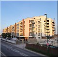
Mariner Point, Brighton Road, Shoreham
Completed in 2018 on the site of a former Royal Mail parcel office.
Image: © Simon Carey Taken: 24 May 2020
0.00 miles
2
Flats, Shoreham Harbour
Called Mariner Point.
Image: © Robin Webster Taken: 21 Jan 2023
0.00 miles
3
Surry Hard
Public slipway south of the Brighton Road-New Road junction. The Riverside Business Centre is to the left.
Image: © Simon Carey Taken: 1 Feb 2009
0.01 miles
4
Mariner Point
Apartment development on the banks of the River Adur, completed in around 2020.
Image: © Ian Capper Taken: 17 Mar 2022
0.02 miles
5
Mariner Point flats from Riverside Business Park. Shoreham
Image: © Robin Webster Taken: 21 Jan 2023
0.02 miles
6
Demolition site off Brighton Road
Image: © Alex McGregor Taken: 13 Feb 2015
0.02 miles
7
Mariners Point Apartment Development, Shoreham-by-Sea
Image: © Richard Cooke Taken: 5 Jun 2018
0.02 miles
8
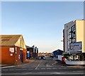
Brighton Road, Shoreham By Sea
The main A259 is on the left whilst New Road is to the right. The former was built to replace the latter.
Image: © Simon Carey Taken: 24 May 2020
0.03 miles
9
New Road, Shoreham
Dating from around 1820, according to maps, it is older than the parallel A259 Brighton Road closer to the shore.
Image: © Robin Webster Taken: 21 Jan 2023
0.03 miles
10
Surry Hard, Shoreham By Sea
Providing access to the Riverside Business Centre as well as being a restricted byway originally allowing public access to a slipway though that is no longer possible.
Image: © Simon Carey Taken: 24 May 2020
0.03 miles
  • ...