IMAGES TAKEN NEAR TO
Buckingham Road, SHOREHAM-BY-SEA, BN43 5UA
Introduction
This page details the photographs taken nearby to Buckingham Road, BN43 5UA by members of the Geograph project.
The Geograph project started in 2005 with the aim of publishing, organising and preserving representative images for every square kilometre of Great Britain, Ireland and the Isle of Man.

There are currently over 7.5m images from over14,400 individuals and you can help contribute to the project by visiting https://www.geograph.org.uk
Image Map
Images are licensed for reuse under creativecommons.org/licenses/by-sa/2.0
Notes
- Clicking on the map will re-center to the selected point.
- The higher the marker number, the further away the image location is from the centre of the postcode.
Image Listing (334 Images Found)
Images are licensed for reuse under creativecommons.org/licenses/by-sa/2.0
Image
Details
Distance
1
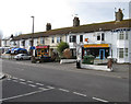
Shops, Buckingham Road
Opposite Image and seem to include the typical fare for commuters, a florist (for those late arrivals when the trains delayed), a newsagent, and two take aways.
Image: © Simon Carey
Taken: 1 Feb 2009
0.02 miles
2

Shoreham-by-Sea : The Crab Tree public house
"Pub on Buckingham Road, built 1908 designed by architect Arthur B Packham, company architect for the brewery Tamplin & Sons Ltd." - see https://www.geograph.org.uk/photo/7913104
Image: © Jim Osley
Taken: 23 Jul 2026
0.03 miles
3
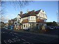
The Crab Tree public house, Shoreham-by-Sea
Image: © Stacey Harris
Taken: 17 Dec 2011
0.03 miles
4
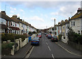
Queens Place
Linking Buckingham Road with Mill Lane. Built in the 1860s after the arrival of the railway.
Image: © Simon Carey
Taken: 1 Feb 2009
0.03 miles
5
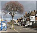
The Crab Tree Inn, Buckingham Road
Next to the railway station north of the level crossing and includes 6 rooms available for bed and breakfast.
Image: © Simon Carey
Taken: 1 Feb 2009
0.04 miles
6
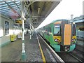
Shoreham-by-Sea, train
A Southern Class 377 EMU ready to leave Platform 1 for Brighton.
Image: © Mike Faherty
Taken: 9 Dec 2017
0.04 miles
7
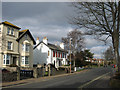
Buckingham Road
Beginning north of the level crossing and heading north to Upper Shoreham Road, the former A27. The older Victorian houses give way to more modern development beyond this point.
Image: © Simon Carey
Taken: 1 Feb 2009
0.04 miles
8
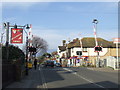
Level crossing at Shoreham-by-Sea
A railway level crossing at Shoreham-by-Sea.
Image: © Malc McDonald
Taken: 5 Mar 2011
0.05 miles
9
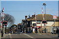
Level Crossing at Shoreham-by-Sea, Sussex
Brunswick Road, near the railway station, with the South Downs visible in the distance.
Image: © Peter Trimming
Taken: 17 Apr 2010
0.05 miles