IMAGES TAKEN NEAR TO
Upper Shoreham Road, SHOREHAM-BY-SEA, BN43 5QB
Introduction
This page details the photographs taken nearby to Upper Shoreham Road, BN43 5QB by members of the Geograph project.
The Geograph project started in 2005 with the aim of publishing, organising and preserving representative images for every square kilometre of Great Britain, Ireland and the Isle of Man.

There are currently over 7.5m images from over14,400 individuals and you can help contribute to the project by visiting https://www.geograph.org.uk
Image Map
Images are licensed for reuse under creativecommons.org/licenses/by-sa/2.0
Notes
- Clicking on the map will re-center to the selected point.
- The higher the marker number, the further away the image location is from the centre of the postcode.
Image Listing (8 Images Found)
Images are licensed for reuse under creativecommons.org/licenses/by-sa/2.0
Image
Details
Distance
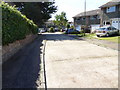
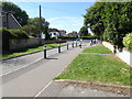
2

Windlesham Gardens around Windlesham Gardens
The road splitting round the small teardrop shaped gardens shares the same name.
Image: © Robin Webster
Taken: 23 Mar 2010
0.17 miles
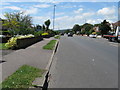
5
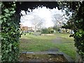
Shoreham-by-Sea, gardens
Windlesham Gardens, an open space between arms of the road with the same name.
Image: © Mike Faherty
Taken: 9 Dec 2017
0.21 miles