
IMAGES TAKEN NEAR TO
Old Fort Road, SHOREHAM-BY-SEA, BN43 5HL
Introduction
This page details the photographs taken nearby to Old Fort Road, BN43 5HL by members of the Geograph project.
The Geograph project started in 2005 with the aim of publishing, organising and preserving representative images for every square kilometre of Great Britain, Ireland and the Isle of Man.

There are currently over 7.5m images from over14,400 individuals and you can help contribute to the project by visiting https://www.geograph.org.uk
Image Map
Images are licensed for reuse under creativecommons.org/licenses/by-sa/2.0
Notes
- Clicking on the map will re-center to the selected point.
- The higher the marker number, the further away the image location is from the centre of the postcode.
Image Listing (104 Images Found)
Images are licensed for reuse under creativecommons.org/licenses/by-sa/2.0
Image
Details
Distance
1
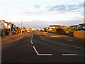
Old Fort Road
Main access road on Shoreham Beach leading to the old 19th century fort.
Image: © Simon Carey
Taken: 29 Mar 2009
0.06 miles
2

Houses along Shoreham Beach
The houses are along Old Fort Road in Shoreham-by-Sea.
Image: © Mat Fascione
Taken: 22 Aug 2025
0.06 miles
3
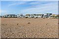
Shoreham Beach
The rear of houses in Old Fort Road overlooking the beach at Shoreham Beach.
Image: © Ian Capper
Taken: 15 Jan 2023
0.06 miles
4
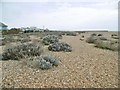
Shoreham Beach
A designated local nature reserve, because of its shingle vegetation: http://www.shoreham-port.co.uk/write/Coastal_Geography_2014-15.pdf
Image: © Mike Faherty
Taken: 7 Apr 2018
0.07 miles
5
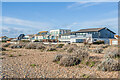
Shoreham Beach
The rear of houses in Old Fort Road overlooking the beach at Shoreham Beach.
Image: © Ian Capper
Taken: 15 Jan 2023
0.07 miles
6
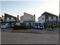
230-234, Harbour Way, Shoreham Beach
Three of a number displaying banners supporting the NHS during the Covid-19 crisis.
Image: © Simon Carey
Taken: 19 May 2020
0.07 miles
7
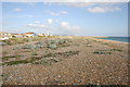
View East along Shoreham Beach
View East along Shoreham Beach showing the entrance to the harbour
Image: © Bob Parkes
Taken: 4 Oct 2007
0.08 miles
8
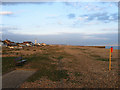
Shoreham Beach
The settlement of Shoreham Beach is built on a shingle spit that reaches as far as Hove which until the early 19th century formed the mouth of the River Adur. A permanent cut was made at Kingston in 1816 with the eastern part eventually becoming part of Shoreham Harbour. The western portion remained shingle until the early 20th century when it began to be colonised by those of a more Bohemian persuasion who ferried former railway carriages across the river to build their settlement. This slowly grew until WW2 when the dwellings were destroyed to prevent use during any possible invasion. After the war the settlement regrew though this time under tight council control.
Image: © Simon Carey
Taken: 29 Mar 2009
0.09 miles
9
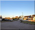
Old Fort Road, Shoreham Beach
The eastern end of the road from the junction with Harbour Way.
Image: © Simon Carey
Taken: 19 May 2020
0.09 miles
10
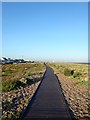
Boardwalk, Shoreham Beach
First laid in 2011 and completed in 2020, the boardwalk has proved very popular with local residents enabling them easier access to the shingle beach. This section looks eastwards with Brighton seafront visible in the distance.
Image: © Simon Carey
Taken: 19 May 2020
0.10 miles