IMAGES TAKEN NEAR TO
Broad Reach, SHOREHAM-BY-SEA, BN43 5ED

Introduction

This page details the photographs taken nearby to Broad Reach, BN43 5ED by members of the Geograph project.

The Geograph project started in 2005 with the aim of publishing, organising and preserving representative images for every square kilometre of Great Britain, Ireland and the Isle of Man.

There are currently over 7.5m images from over14,400 individuals and you can help contribute to the project by visiting https://www.geograph.org.uk

Image Map


Images are licensed for reuse under creativecommons.org/licenses/by-sa/2.0
Notes
  • Clicking on the map will re-center to the selected point.
  • The higher the marker number, the further away the image location is from the centre of the postcode.

Image Listing (199 Images Found)

Images are licensed for reuse under creativecommons.org/licenses/by-sa/2.0
  • ...
Image
Details
Distance
1
Sculptures, Ropetackle Development
Recently constructed and opened development built on the former site of a council depot. Much of the western part of the Adur waterfront is now losing its industrial heritage to new riverside developments. The Norfolk Road Bridge is in the background.
Image: © Simon Carey Taken: 12 Nov 2006
0.03 miles
2
River Adur
Looking across the River Adur towards the viaduct carrying the West Coastway railway over the river, with Ringed Plover Apartments in Salt Marsh Road beyond.
Image: © Ian Capper Taken: 17 Mar 2022
0.03 miles
3
Linemans View
Part of the Ropetackle development overlooking the River Adur, completed in 2005.
Image: © Ian Capper Taken: 17 Mar 2022
0.04 miles
4
Rail Bridge over River Adur, Shoreham
Image: © Paul Gillett Taken: 25 Jul 2013
0.04 miles
5
Ropetackle
Viewed from the Sea Scouts' landing stage on the western bank of the river. Constructed a few years ago on the site of a former council depot.
Image: © Simon Carey Taken: 8 Apr 2008
0.04 miles
6
Adur Railway Bridge
Carrying a South West train service from Brighton to Basingstoke. Taken from a shingle bank on the River Adur at low tide.
Image: © Simon Carey Taken: 7 Dec 2008
0.04 miles
7
Yachts near Railway Viaduct
The viaduct crosses the River Adur at Shoreham
Image: © Paul Gillett Taken: 16 May 2010
0.04 miles
8
Shoreham Railway Bridge
The current iron girder bridge dates from 1911 having replaced the original 1845 wooden trestle bridge. The view from underneath at low tide with a Brighton bound train passing overhead.
Image: © Simon Carey Taken: 25 May 2020
0.04 miles
9
Broad Reach, Shoreham By Sea
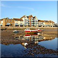
Part of the Ropetackle development viewed at low tide.
Image: © Simon Carey Taken: 25 May 2020
0.05 miles
10
Kittiwake Court, Shoreham By Sea
Part of the new Waterfront Development that is taking place north of the railway line. It has taken some time to get going, see Image from 2008.
Image: © Simon Carey Taken: 25 May 2020
0.05 miles
  • ...