IMAGES TAKEN NEAR TO
Basin Road North, BRIGHTON, BN41 1WA

Introduction

This page details the photographs taken nearby to Basin Road North, BN41 1WA by members of the Geograph project.

The Geograph project started in 2005 with the aim of publishing, organising and preserving representative images for every square kilometre of Great Britain, Ireland and the Isle of Man.

There are currently over 7.5m images from over14,400 individuals and you can help contribute to the project by visiting https://www.geograph.org.uk

Image Map


Images are licensed for reuse under creativecommons.org/licenses/by-sa/2.0
Notes
  • Clicking on the map will re-center to the selected point.
  • The higher the marker number, the further away the image location is from the centre of the postcode.

Image Listing (217 Images Found)

Images are licensed for reuse under creativecommons.org/licenses/by-sa/2.0
  • ...
Image
Details
Distance
1
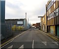
Basin Road North, Aldrington, Hove
The road runs from Wharf Road back to the A259 at the junction with the B2194 providing access for business adjacent to North Basin Quay at the eastern end of Shoreham Harbour.
Image: © Simon Carey Taken: 22 Dec 2016
0.02 miles
2
Derek Avenue
Image: © N Chadwick Taken: 4 Jul 2015
0.02 miles
3
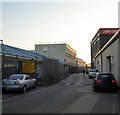
North Basin Road, Aldrington, Hove
Linking Wharf Road to the A259. Maritime House is on the left.
Image: © Simon Carey Taken: 8 May 2020
0.03 miles
4
345-367, Kingsway, Aldrington, Hove
A mixture of single and semi-detached properties located between St Keyna Avenue and Derek Avenue that were developed in the early 1930s.
Image: © Simon Carey Taken: 22 Dec 2016
0.03 miles
5
341-343, Kingsway, Aldrington, Hove
A pair of houses located in the block between Derek Avenue and Brittany Road along with Image to the east that were built in the late 1920s.
Image: © Simon Carey Taken: 22 Dec 2016
0.03 miles
6
Glastonbury Road, Aldrington, Hove
A small residential road that links St Keyna Avenue to Derek Avenue that was developed in the 1920s though the houses on the southern side were not completed until the 1930s.
Image: © Simon Carey Taken: 3 Dec 2016
0.05 miles
7
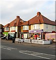
333-339, Kingsway, Aldrington, Hove
A pair of semi-detached houses that have been converted into commercial premises: 333 is a cafe; 334 a hair salon; 335 an accountant; 336 a chartered surveyor's office. The houses were constructed in the late 192os and occupy a block between Brittany Road and Derek Avenue along with Image to the west.
Image: © Simon Carey Taken: 22 Dec 2016
0.05 miles
8
Portslade-by-Sea : Aldrington Basin
Image: © Jim Osley Taken: 4 Apr 2021
0.06 miles
9
Brittany Rd
Image: © N Chadwick Taken: 4 Jul 2015
0.06 miles
10
364, Kingsway, Aldrington, Hove
One of the few buildings on the southern side of the road and currently occupied by Pets Corner.
Image: © Simon Carey Taken: 3 Dec 2016
0.07 miles
  • ...