1
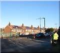
Churchill House, Hangleton Road, Hangleton, Hove
A council run retirement home built in 1967 and renovated in 1990. Viewed from the junction with Stapley Road.
Image: © Simon Carey
Taken: 22 Dec 2016
0.06 miles
2
Hangleton Road
Image: © Stacey Harris
Taken: 17 Dec 2011
0.07 miles
3
Hangleton Road
Image: © Stacey Harris
Taken: 17 Dec 2011
0.09 miles
4
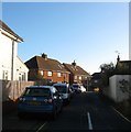
Hangleton Gardens, Hangleton, Hove
A residential road that links Hangleton Way to Hangleton Road, the A2038. Originally the road was a country lane heading east to West Blatchington from the old lane to Hangleton that formed the northern border of the parish of Aldrington. As the area was developed in the mid to late 1930s, Hangleton Road was widened and given a curve a little to the south reducing this former part as a quiet residential backwater. The houses on the left were built in the late 1930s.
Image: © Simon Carey
Taken: 22 Dec 2016
0.10 miles
5
Old School Place, Knoll Estate, Hove
A cul de sac off Stapley Road that was built in 2005 on the site of Knoll Infants School which operated here from 1956 until closure after amalgamation in 2001. The original infants school had moved from a site on Bellingham Crescent.
The Knoll Estate is located in the former northern portion of the parish of Aldrington which was once three open fields called The Knowle East, The Knowle West and The Knowle North according to its 1840 tithe map. The area was developed by Hove council from 1926 and mostly completed by 1939, the remaining undeveloped part at the northern end of Stapley Road was finished in the late 1940s.
Image: © Simon Carey
Taken: 22 Dec 2016
0.11 miles
6
The southern end of Poplar Avenue
Image: © Shazz
Taken: 27 Jun 2011
0.15 miles
7
Knoll Close, Knoll Estate, Hove
A cul de sac off Godwin Road that was built in 1948.
The Knoll Estate is located in the former northern portion of the parish of Aldrington which was once three open fields called The Knowle East, The Knowle West and The Knowle North according to its 1840 tithe map. The area was developed by Hove council from 1926 and mostly completed by 1939, the remaining undeveloped part at the northern end of Stapley Road was finished in the late 1940s.
Image: © Simon Carey
Taken: 22 Dec 2016
0.16 miles
8
Godwin Road, Knoll Estate, Hove
The northern section of the residential road linking Bellingham Crescent to Stapley Road that was developed in the 1930s.
The Knoll Estate is located in the former northern portion of the parish of Aldrington which was once three open fields called The Knowle East, The Knowle West and The Knowle North according to its 1840 tithe map. The area was developed by Hove council from 1926 and mostly completed by 1939, the remaining undeveloped part at the northern end of Stapley Road was finished in the late 1940s.
Image: © Simon Carey
Taken: 22 Dec 2016
0.16 miles
9
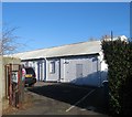
131a, Stapley Road, Knoll Estate, Hove
Tucked away on the footpath that links Stapley Road to Rowan Avenue via Knoll Recreation Ground is this rather utilatarian building that is currently occupied by Little lambs Kindergarten. The building dates from the 1940s and is marked on the 1951-64 OS maps as a central kitchen and on a 1986 edition as a training centre and looks as if it was once council owned.
Image: © Simon Carey
Taken: 5 Jan 2017
0.17 miles
10
Lions Gate, Rowan Ave, Hove
This block of flats is owned by Brighton Lions Housing Society and let to senior citizens at affordable rents.
Image: © Brian Slater
Taken: 7 Apr 2009
0.17 miles


