IMAGES TAKEN NEAR TO
Clayton Way, HOVE, BN3 8GE
Introduction
This page details the photographs taken nearby to Clayton Way, BN3 8GE by members of the Geograph project.
The Geograph project started in 2005 with the aim of publishing, organising and preserving representative images for every square kilometre of Great Britain, Ireland and the Isle of Man.

There are currently over 7.5m images from over14,400 individuals and you can help contribute to the project by visiting https://www.geograph.org.uk
Image Map
Images are licensed for reuse under creativecommons.org/licenses/by-sa/2.0
Notes
- Clicking on the map will re-center to the selected point.
- The higher the marker number, the further away the image location is from the centre of the postcode.
Image Listing (31 Images Found)
Images are licensed for reuse under creativecommons.org/licenses/by-sa/2.0
Image
Details
Distance
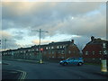
1
Poynings Drive, Hangleton, Hove
Residential road built in the 1940s heading north from Downlands Drive.
Image: © Simon Carey
Taken: 15 Apr 2020
0.03 miles
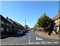
2
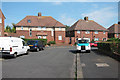
Hangleton Road, junction with Court Farm Road
Image: © Stacey Harris
Taken: 17 Dec 2011
0.12 miles
3
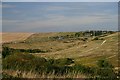
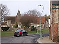
South Downs from the northern edge of Hove
The A27 cuts across the Downs to the north of Hove. In the middle ground are tracks made by motorcycle scramblers.
Image: © Bob Jones
Taken: 9 Aug 2005
0.13 miles
6
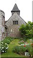
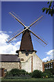
The western elevation of West Blatchington church
Image: © Shazz
Taken: 11 Jun 2016
0.15 miles
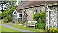
7
Parish church of St Peter, West Blatchington
It was rebuilt from medieval ruins in 1890 using flint with stone dressings, the architect being Somers Clarke. Major enlargements were added in 1960-62 on the north side, this time designed by J. L. Denman in flint with red brick dressings. www.acny.org.uk/venue.php?V=5205
Image: © Peter Holmes
Taken: 26 Jan 2008
0.16 miles
8
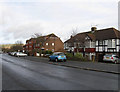
Nevill Road
The A2023 leaves the square and is about to meet the junction with the A2038. The South Downs can be seen in the distance to the left. This part of the road was built up from the 1930s and originally Nevill Road remained the name up to the junction with Dyke Road, however, that part was renamed King George VI Avenue in 1936. The block of flats to the right are Balmoral Court.
Image: © Simon Carey
Taken: 18 Jan 2009
0.16 miles
9
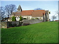
Southern elevation of West Blatchington church
Image: © Shazz
Taken: 11 Jun 2016
0.16 miles