
IMAGES TAKEN NEAR TO
Harmsworth Crescent, HOVE, BN3 8BU
Introduction
This page details the photographs taken nearby to Harmsworth Crescent, BN3 8BU by members of the Geograph project.
The Geograph project started in 2005 with the aim of publishing, organising and preserving representative images for every square kilometre of Great Britain, Ireland and the Isle of Man.

There are currently over 7.5m images from over14,400 individuals and you can help contribute to the project by visiting https://www.geograph.org.uk
Image Map
Images are licensed for reuse under creativecommons.org/licenses/by-sa/2.0
Notes
- Clicking on the map will re-center to the selected point.
- The higher the marker number, the further away the image location is from the centre of the postcode.
Image Listing (25 Images Found)
Images are licensed for reuse under creativecommons.org/licenses/by-sa/2.0
Image
Details
Distance
1
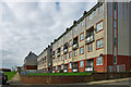
Flats overlooking Hangleton Park
The park is a small open space with a children's play area. The flats are accessed from Harmsworth Crescent that runs behind them.
Image: © Robin Webster
Taken: 3 Apr 2010
0.01 miles
4
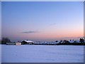
West Blatchington Infant and Junior Schools
Located on the outskirts of Brighton and viewed from the Monarch's Way at dusk.
Image: © Simon Carey
Taken: 7 Jan 2010
0.14 miles
5
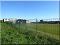
King's School, Hangleton, Hove
Opened as a Free School in 2013 utilising the buildings of the old Portslade Sixth Form College before moving here and opening in August 2019. Since then the school had to close due to storm damage in December 2019 and again because of the Covid-19 crisis in March 2020. Previously occupied by West Blatchington Infants and Junior School, see Image], which has now been rebuilt and shares the site with King's.
Image: © Simon Carey
Taken: 15 Apr 2020
0.16 miles
6
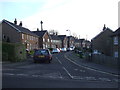
Barnet Way, Hangleton
Barnet Way in Hangleton, near Hove in Sussex.
Image: © Malc McDonald
Taken: 9 Dec 2012
0.17 miles
8
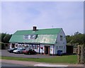
New Downsman pub, Hangleton
near the start of the Dyke Railway Trail http://www.beerintheevening.com/pubs/s/33/33611/New_Downsman/Hove
Image: © Paul Gillett
Taken: 11 Aug 2012
0.19 miles
9
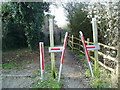
Gateway on The Monarch's Way
With the gate to the left open this interesting device seems of little use.
Image: © Peter Holmes
Taken: 26 Jan 2008
0.20 miles
10
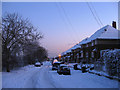
Downland Drive
Part of the Sunninghill estate that was built in the immediate postwar reputedly with assistance of German POWs. The houses look over Toads Hole Valley.
Image: © Simon Carey
Taken: 7 Jan 2010
0.20 miles