
IMAGES TAKEN NEAR TO
Hangleton Valley Drive, HOVE, BN3 8AP
Introduction
This page details the photographs taken nearby to Hangleton Valley Drive, BN3 8AP by members of the Geograph project.
The Geograph project started in 2005 with the aim of publishing, organising and preserving representative images for every square kilometre of Great Britain, Ireland and the Isle of Man.

There are currently over 7.5m images from over14,400 individuals and you can help contribute to the project by visiting https://www.geograph.org.uk
Image Map
Images are licensed for reuse under creativecommons.org/licenses/by-sa/2.0
Notes
- Clicking on the map will re-center to the selected point.
- The higher the marker number, the further away the image location is from the centre of the postcode.
Image Listing (25 Images Found)
Images are licensed for reuse under creativecommons.org/licenses/by-sa/2.0
Image
Details
Distance
1
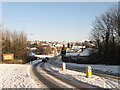
Hangleton Lane
Once a farm track linking a couple of downland farms now a link road between the suburb of Hangleton and Hangleton Link Road, the A293, an access road for the Brighton by-pass.
Image: © Simon Carey
Taken: 7 Jan 2010
0.02 miles
2
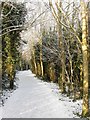
Footpath and Cycleway, Benfield Valley
Part of the Benfield Valley Nature Reserve the footpath and cycleway start on the A270 and follow the eastern side of the reserve to Hangleton Lane then beyond up to the A270 before turning east and heading down to Hangleton.
Image: © Simon Carey
Taken: 7 Jan 2010
0.02 miles

5
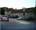
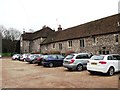
Hangleton Manor
Tucked away in a rather non-descript suburb of Brighton and Hove is the oldest domestic building still in use within the conurbation. Built in 1560 the building has been in use ever since becoming a restaurant/bar a few years ago. The garden still possesses the manor's original dovecote.
Image: © Simon Carey
Taken: 16 Sep 2005
0.04 miles
6
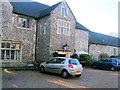
Hangleton Manor
The manor house is the oldest secular building in the Hove part of the city; some 15th-century features remain, and there has been little change since the High Sheriff of Sussex rebuilt it in the mid-16th century http://en.wikipedia.org/wiki/Hangleton_Manor_Inn
Image: © Paul Gillett
Taken: 7 Dec 2012
0.06 miles
7
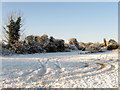
Car Park, Benfield Valley Golf Course
The 9 hole golf course is situated in the northern part of Benfield Valley using some of the fairways vacated by West Hove Golf Course when it relocated north of the A27. The chimney in view is one of the few structural remains of a row of late 19th century agricultural labourer's cottages that were built on the site of Benfield Manor Farm which was demolished in 1871.
Image: © Simon Carey
Taken: 7 Jan 2010
0.06 miles
9
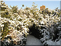
Underneath the Arches
This path requires some bending of the knees to duck under the low lying foliage. The chimney is the only remaining structure left standing of a row of late Victorian agricultural labourer's cottages that were built on the site of Benfield Manor Farm that was demolished in 1871.
Image: © Simon Carey
Taken: 7 Jan 2010
0.09 miles
10
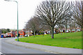
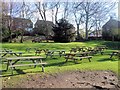
St Helen's Park
The bottom end of the park, which although quite large, is really just a green. It is roughly triangular, extending up to St Helen's church at its apex.
Image: © Robin Webster
Taken: 3 Apr 2010
0.10 miles