1
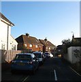
Godwin Road, Knoll Estate, Hove
The northern section of the residential road linking Bellingham Crescent to Stapley Road that was developed in the 1930s.
The Knoll Estate is located in the former northern portion of the parish of Aldrington which was once three open fields called The Knowle East, The Knowle West and The Knowle North according to its 1840 tithe map. The area was developed by Hove council from 1926 and mostly completed by 1939, the remaining undeveloped part at the northern end of Stapley Road was finished in the late 1940s.
Image: © Simon Carey
Taken: 22 Dec 2016
0.07 miles
2
Hangleton Gardens, Hangleton, Hove
A residential road that links Hangleton Way to Hangleton Road, the A2038. Originally the road was a country lane heading east to West Blatchington from the old lane to Hangleton that formed the northern border of the parish of Aldrington. As the area was developed in the mid to late 1930s, Hangleton Road was widened and given a curve a little to the south reducing this former part as a quiet residential backwater. The houses on the left were built in the late 1930s.
Image: © Simon Carey
Taken: 22 Dec 2016
0.07 miles
3
Houses on Hangleton Road
Hangleton Way to left after pedestrian crossing.
Image: © Oast House Archive
Taken: 16 Oct 2010
0.08 miles
4
Hangleton Road
Image: © Stacey Harris
Taken: 17 Dec 2011
0.09 miles
5
Knoll Close, Knoll Estate, Hove
A cul de sac off Godwin Road that was built in 1948.
The Knoll Estate is located in the former northern portion of the parish of Aldrington which was once three open fields called The Knowle East, The Knowle West and The Knowle North according to its 1840 tithe map. The area was developed by Hove council from 1926 and mostly completed by 1939, the remaining undeveloped part at the northern end of Stapley Road was finished in the late 1940s.
Image: © Simon Carey
Taken: 22 Dec 2016
0.12 miles
6
Martin Road, Knoll Estate, Hove
A residential road that links Hangleton Road, the A2038, with Stapley Road that was laid out in the 1920s, but not developed until the 1940s.
The Knoll Estate is located in the former northern portion of the parish of Aldrington which was once three open fields called The Knowle East, The Knowle West and The Knowle North according to its 1840 tithe map. The area was developed by Hove council from 1926 and mostly completed by 1939, the remaining undeveloped part at the northern end of Stapley Road was finished in the late 1940s.
Image: © Simon Carey
Taken: 22 Dec 2016
0.12 miles
7
Plant and shrubs
Photo taken behind Hove Sainsbury's
Image: © Paul Gillett
Taken: 20 Jun 2009
0.14 miles
8
Shoreham-by-sea and the south coast from the air
Viewed from a Paris bound flight from Glasgow.
Image: © Thomas Nugent
Taken: 30 Aug 2016
0.14 miles
9
Shoreham-by-sea and the south coast from the air
Portslade Village, Shoreham Beach and the River Adur can be seen in this photo which was taken from a Paris bound flight from Glasgow. Brighton City Airport and Worthing can also be seen.
Image: © Thomas Nugent
Taken: 30 Aug 2016
0.14 miles
10
Hangleton Road
Image: © Stacey Harris
Taken: 17 Dec 2011
0.15 miles


