1
Traffic Lights, Nevill Road
Controlling the junction with Woodland Drive and The Droveway. Nevill Road turns to the left at this point following the course of the old east-west droveway which runs along the western side of the former Goldstone Bottom whose dip can be seen to the right.
Image: © Simon Carey
Taken: 18 Jan 2009
0.03 miles
2
Eridge Road
The first of 5 small cul-de-sacs that leave the southern side of Nevill Road and Court Farm Road though it is also the access road for Aldrington Primary School, North Nevill allotments and Nevill Playing Field. All were constructed in the late 1930s.
Image: © Simon Carey
Taken: 18 Jan 2009
0.04 miles
3
Nevill Road
I wonder if the estate agent selling one of the houses opposite will promote the off road parking facility. This part of Nevill Road was originally an ancient east-west droveway that followed the Downs through the then small villages of Preston and West Blatchington. Nevill Road was named in 1928 and built up when Hove corporation took over the running of the former parish of West Blatchington, with many of the houses built in the late 1930s. Taken from the corner of Eridge Road the land drops into what was once Goldstone Bottom behind the houses.
Image: © Simon Carey
Taken: 18 Jan 2009
0.05 miles
4
Nevill Road Co-op
Subsequent to the photo the store was taken over by Waitrose in April 2014 http://savehove.wordpress.com/2013/11/11/the-co-op-superstore-to-be-a-waitrose-branch-from-april-2014/
Image: © Paul Gillett
Taken: 12 Dec 2010
0.05 miles
5
Entrance to Waterworks Cottages
The cottages are former staff houses for workers for the former waterworks which is now the British Engineerium museum which is located behind the photographer on Woodland Drive.
Image: © Simon Carey
Taken: 18 Jan 2009
0.06 miles
6
The Engineerium - 1866 beam engine house
This is home to the 1866 Easton & Amos of London Woolf compound rotative beam pumping engine. The house was not open on this occasion as it contained various items in store and under dust-sheets. The ivy covered structure is a grotto made of material recovered from the wells during excavation.
Image: © Chris Allen
Taken: 20 Nov 2011
0.07 miles
7
British Engineerium by Hove Park
Although closed for restoration, this former Victorian Pumping Station is usually open once a month to show the work in progress.
Image: © Dave Spicer
Taken: 18 Dec 2012
0.07 miles
8
Goldstone pumping Station - beam engine
This is the older of the two Woolf compound beam pumping engines and was built in 1866 by Easton, Amos & Sons of London and stopped in the late 1940s. As seen here it was incomplete, inoperable and surrounded by a variety of artefacts. The site is currently being refurbished and it is claimed this engine will be returned to an operable condition. The cylinders are 28" x 64.75" & 46" x 96" and it was good for 204 ihp on test. Normal speed was 12-16 rpm on steam at 70 psi. The other beam engine is operable and is truly spectacular.
Image: © Chris Allen
Taken: 5 Aug 2001
0.08 miles
9
The Engineerium - economiser
This is the top end of the economiser by E Green & Son Ltd. The tubes are scraped clean of soot by self-reversing scraper gear driven by belt from the small horizontal single cylinder steam engine on top. The Engineerium was in steam for the last time for a couple of years while major works are undertaken. This top class museum was closed and may have been lost to the public but a major benefactor purchased it at the last minute.
Image: © Chris Allen
Taken: 20 Nov 2011
0.08 miles
10
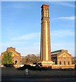
British Engineerium, Hove
Built in 1866 as the Goldstone Pumping Station to supply water to Brighton and Hove. The station remained in operation until 1971 when it was considered outdated and closed. The building was saved from demolition along with the machinery inside by Jonathan Minns who would acquire a lease in 1974 in order to set up a museum and learning centre. This opened in 1976 and became a renowned engineering heritage centre, however, it continually struggled for funds and was eventually closed in 2006, with the buildings and machinery put up for sale in separate lots. The threat of the collection being split up was enough to get a local businessman, Mike Holland, to step in and save it 25 minutes before the auction commenced and continue the work of Minns. As yet the museum has not reopened fully due to ongoing restoration work but there are a number of open days held at various times. The flint wall was also built in 1866 as was the drinking fountain which contains the warning 'Commit no nuisance' which I guess is Victorian for don't piddle in it.
Image: © Simon Carey
Taken: 22 Jan 2017
0.08 miles


