1
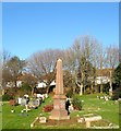
Forte Family Graves, Hove Cemetery
Located at the north eastern of the cemetery and I believe are related to Charles Forte, of restaurant fame. The foliage beyond marks the old course of the Dyke Railway that was in operation from 1897 to 1938.
Hove Cemetery consists of two parts, the original section south of Old Shoreham Road that was first consecrated in 1882 and a second to the north of the road that opened in 1923 as an extension. The northern section is divided further by a public footpath that links the A270 to Elm Drive.
Image: © Simon Carey
Taken: 5 Jan 2017
0.04 miles
2
Elm Drive looking west from the junction with Maple Gardens
Image: © Shazz
Taken: 27 Jun 2011
0.04 miles
3
Hove Cemetery in the Snow
The section of the cemetery to the north of Old Shoreham Road which I believe is a postwar extension, The line of bushes to the right at the end of the cemetery marks the course of the old Dyke railway which operated between 1887-1938.
Image: © Simon Carey
Taken: 7 Jan 2010
0.05 miles
4
Monument, Hove Cemetery
I neglected to remember who this family monument belongs to but it is located in the north east section of the cemetery near to the footpath. The trees beyond mark the course of the former Dyke Railway which operated from 1887 to 1938 and behind them are houses which front onto Elm Drive.
Hove Cemetery consists of two parts, the original section south of Old Shoreham Road that was first consecrated in 1882 and a second to the north of the road that opened in 1923 as an extension. The northern section is divided further by a public footpath that links the A270 to Elm Drive.
Image: © Simon Carey
Taken: 5 Jan 2017
0.06 miles
5
Coptic Graves, Hove Cemetery
Located at the eastern end of the cemetery. There is an important Coptic Christian church in Hove.
Hove Cemetery consists of two parts, the original section south of Old Shoreham Road that was first consecrated in 1882 and a second to the north of the road that opened in 1923 as an extension. The northern section is divided further by a public footpath that links the A270 to Elm Drive.
Image: © Simon Carey
Taken: 5 Jan 2017
0.06 miles
6
Hove Cemetery
This is the northern section which was opened just after World War Two I believe. Between the bushes and houses on the right lies the course of the old Dyke railway which was open between 1887-1939.
Image: © Simon Carey
Taken: 14 Jan 2009
0.07 miles
7
Hove fire station
Hove fire station, English Close, Hove, East Sussex with a Volvo pumping appliance outside.
Image: © Kevin Hale
Taken: 16 Jun 2007
0.08 miles
8
47-53, Elm Drive, Hove
The two pairs of semi-detached houses on the left were built in the 1930s and occupy the site of Gibbets Farm. Originally a barn where two labourers Edward Howell and James Rooke hid in 1792 to share the proceeds of the letters they had just robbed from a mail boy on the Old Shoreham Road in nearby Goldstone Bottom, now Hove Park. Both were soon identified, arrested and put on trail in Horsham where they were found guilty and sentenced to hang. Their bodies were gibbeted overlooking the scene of their crime where Rooke's mother would often be found waiting for the bones to drop so she could collect and give the body a proper burial. Tennyson's peom 'Rizpah' is alleged to have been based on the story.
Subsequently, the barn became known as Gibbets Barn which sometime in the mid 19th century had two cottages built next to it. One of the last tenants, Samuel Holmes, converted them into a single dwelling becoming the farmhouse of Gibbets Farm. The farm operated until 1930 when the land was sold for housing and subsequently demolished to make way for the houses in Elm Drive.
See
Barns, Gibbet Farm (Date unknown) - http://regencysociety-jamesgray.com/volume37/source/jg_37_107.html
Farmhouse, Gibbets Farm (1912) - http://regencysociety-jamesgray.com/volume37/source/jg_37_109.html
Image: © Simon Carey
Taken: 5 Jan 2017
0.08 miles
9
Hove Cemetery
The northern section which I think is a postwar extension. Viewed from Old Shoreham Road which separates the two halves beyond the line of trees in the background is the course of the old Dyke railway opened between 1887-1939.
Image: © Simon Carey
Taken: 14 Jan 2009
0.08 miles
10
War Memorial, Hove Cemetery
One of two in Hove Cemetery, in the southern section is one dedicated tothose who died World War One, whilst this one in the north is for those who lost their lives in World War Two. There are 37 graves here and are located at the far eastern end.
Hove Cemetery consists of two parts, the original section south of Old Shoreham Road that was first consecrated in 1882 and a second to the north of the road that opened in 1923 as an extension. The northern section is divided further by a public footpath that links the A270 to Elm Drive.
Hove Cemetery consists of two parts, the original section south of Old Shoreham Road that was first consecrated in 1882 and a second to the north of the road that opened in 1923 as an extension. The northern section is divided further by a public footpath that links the A270 to Elm Drive.
Image: © Simon Carey
Taken: 5 Jan 2017
0.08 miles


