
IMAGES TAKEN NEAR TO
Aldrington Avenue, HOVE, BN3 7EN
Introduction
This page details the photographs taken nearby to Aldrington Avenue, BN3 7EN by members of the Geograph project.
The Geograph project started in 2005 with the aim of publishing, organising and preserving representative images for every square kilometre of Great Britain, Ireland and the Isle of Man.

There are currently over 7.5m images from over14,400 individuals and you can help contribute to the project by visiting https://www.geograph.org.uk
Image Map
Images are licensed for reuse under creativecommons.org/licenses/by-sa/2.0
Notes
- Clicking on the map will re-center to the selected point.
- The higher the marker number, the further away the image location is from the centre of the postcode.
Image Listing (104 Images Found)
Images are licensed for reuse under creativecommons.org/licenses/by-sa/2.0
Image
Details
Distance
1
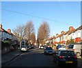
Aldrington Avenue, Aldrington, Hove
A residential road linking Old Shoreham Road to Amherst Crescent that was constructed in 1930-31.
Image: © Simon Carey
Taken: 5 Jan 2017
0.02 miles
2
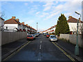
Lullington Avenue
Small estate built in the 1930s, the road connects Amherst Crescent with Old Shoreham Road, the A270.
Image: © Simon Carey
Taken: 14 Jan 2009
0.04 miles
3
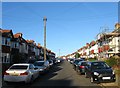
Lullington Avenue, Aldrington, Hove
A residential road linking Old Shoreham Road to Amherst Crescent that was built in 1930-31.
Image: © Simon Carey
Taken: 5 Jan 2017
0.04 miles
4

Amherst Crescent
Estate built in the 1930s north of the West Coastway Line. Access to Aldrington station is down the path to the right.
Image: © Simon Carey
Taken: 14 Jan 2009
0.06 miles
5
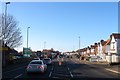
Old Shoreham Road, Hove
The road is ancient predating all building either side and is believed to follow an old Roman route that ran westwards to a crossing of the River Adur at Old Shoreham. Much of the housing in view was developed during the 1930s as Hove began extending northwards whilst the road itself had become the A27 which it remained until the opening of the bypass between 1991-95 after which it bcame the A270.
Image: © Simon Carey
Taken: 5 Jan 2017
0.08 miles
6

Council Incinerator, St Joseph's Trading Estate
Viewed from the western end of Aldrington station.
Image: © Simon Carey
Taken: 14 Jan 2009
0.08 miles
7
Milcote Avenue, Aldrington, Hove
A residential road that links Old Shoreham Road to Amherst Crescent that was constructed in 1930-31.
Image: © Simon Carey
Taken: 5 Jan 2017
0.08 miles
8

Milcote Avenue
Small housing estate built in the 1930s. The road connects Amherst Crescent with Old Shoreham Road, the A270.
Image: © Simon Carey
Taken: 14 Jan 2009
0.08 miles
9

Junction of Lullington Avenue with Amherst Crescent
A similar earlier view is at http://www.geograph.org.uk/photo/1120172.
Image: © Shazz
Taken: 27 Jun 2011
0.09 miles
10

Access to Aldrington Station
Opened as a halt in 1905 the station still has rudimentary access and facilities today. This is the beginning of the long walk to the platform for eastbound trains, longer than the westbound side due to the staggered platforms.
Image: © Simon Carey
Taken: 14 Jan 2009
0.09 miles