1
Hove Park School
Originally Hove County Grammar School for Girls until reorganisation in 1979 turned into the current mixed comprehensive.
Image: © Simon Carey
Taken: 18 Jan 2009
0.03 miles
2
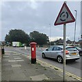
Postbox, Nevill Avenue, Hove
Image: © PAUL FARMER
Taken: 16 Sep 2023
0.06 miles
3
Nevill Road, Hove
The current A2023 runs north from Old Shoreham Road, the A270, to Hangleton Road, the A2038 and was constructed in 1932 to replace an old country lane that ran roughly along the gardens of the houses to the left.
Image: © Simon Carey
Taken: 22 Jan 2017
0.06 miles
4
Road junction between Neville Road and Neville Avenue, Hove
Image: © nick macneill
Taken: 2 Aug 2011
0.06 miles
5
Playing Field, Hove Park School
Built on the site of former allotments in the 1930s when the originally Hove County Grammar School for Girls. The current mixed comprehensive originates from 1979 when a number of schools were reorganised in the area. The houses beyond the rugby posts are the rear of those in Nevill Road.
Image: © Simon Carey
Taken: 18 Jan 2009
0.06 miles
6
Nevill Road
Originally a farm track that linked Old Shoreham Road with The Droveway within the parish of West Blatchington. It was taken over by Hove corporation in 1928 and begun to be developed in the 1930s and originally extended up to the junction with Dyke Road but now stops at the junction with the A2038.
Image: © Simon Carey
Taken: 18 Jan 2009
0.07 miles
7
Playing Field, Hove Park School
Allotments until the 1930s when the land was given over to Hove County Grammar School for Girls. The current mixed comprehensive originated from a reorganisation in 1979.
Image: © Simon Carey
Taken: 18 Jan 2009
0.07 miles
8
Nevill Avenue
Linking Nevill Road, the A2023, with Hangleton Road, the A2038. The road was constructed in 1932 and the houses followed soon after on land that was once allotments.
Image: © Simon Carey
Taken: 18 Jan 2009
0.07 miles
9
Nevill Court, Nevill Road, Hove
Located at the junction of Nevill Road and Nevill Avenue and built in the 1930s.
Image: © Simon Carey
Taken: 22 Jan 2017
0.07 miles
10
Nevill Court
On the Nevill Road/Nevill Avenue roundabout opposite the southern exit of the Brighton & Hove Stadium.
Image: © Simon Carey
Taken: 18 Jan 2009
0.09 miles


