1
Sackville Rd
View siouth down Sackville Rd with its Victorian terraced houses close to the junction with Frith St.
Image: © Nigel Mykura
Taken: 13 Feb 2011
0.03 miles
2
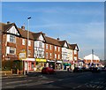
Shops, Sackville Road
Between Frith Road on the left and Old Shoreham Road on the extreme right. The mock Tudor pub at the junction is the Hove Park Tavern.
Image: © Simon Carey
Taken: 14 Oct 2007
0.04 miles
3
Furniture Village, Hove
Image: © Alex McGregor
Taken: 13 Aug 2014
0.06 miles
4
Entrance, Sackville Trading Estate
Built in the 1970s on the site of Hove Goods Yard. The entrance to the immediate right leads to Corrals who still work from a few of the original coal bays the rest now used by a firm dealing with clamped cars. The estate includes warehouses containing Vokins, Halfords and Focus DIY amongst others.
Image: © Simon Carey
Taken: 14 Oct 2007
0.07 miles
5
Hove Park Tavern
Image: © David Lally
Taken: 11 Jun 2023
0.07 miles
6
The sign of the Hove Park Tavern
Image: © David Lally
Taken: 11 Jun 2023
0.08 miles
7
Development, Sackville Road, Hove
A trading estate (
Image]) has largely been cleared for a new housing development, which will also include offices and public gardens. Housing will include more than 500 build to rent homes and 260 care community homes (whatever they are). Developers Moda Living.
Image: © Stephen Richards
Taken: 26 Dec 2021
0.08 miles
8
85, Old Shoreham Road, Hove
Located on the corner of Nevill Road at a rather busy road junction. Currently occupied by Kwik Fit though the building dates back to the 1920s.
Image: © Simon Carey
Taken: 5 Jan 2017
0.09 miles
9
87-101, Old Shoreham Road, Hove
A parade of shops on the western side of the junction with Neveill Road, the A2023, that were built in the mid 1930s. Currently occupied by a shed retailer, funeral directors, newsagent, pizza delivery chain, barbers, electrical retailer, tanning salon and a sandwich shop.
Image: © Simon Carey
Taken: 22 Jan 2017
0.10 miles
10
69-73, Old Shoreham Road, Hove
A small parade of shops occupied by a deli, Indian restaurant and chartered surveyor, that were built in the late 1920s.
Image: © Simon Carey
Taken: 5 Jan 2017
0.10 miles


