
IMAGES TAKEN NEAR TO
Benett Avenue, HOVE, BN3 6UR
Introduction
This page details the photographs taken nearby to Benett Avenue, BN3 6UR by members of the Geograph project.
The Geograph project started in 2005 with the aim of publishing, organising and preserving representative images for every square kilometre of Great Britain, Ireland and the Isle of Man.

There are currently over 7.5m images from over14,400 individuals and you can help contribute to the project by visiting https://www.geograph.org.uk
Image Map
Images are licensed for reuse under creativecommons.org/licenses/by-sa/2.0
Notes
- Clicking on the map will re-center to the selected point.
- The higher the marker number, the further away the image location is from the centre of the postcode.
Image Listing (100 Images Found)
Images are licensed for reuse under creativecommons.org/licenses/by-sa/2.0
Image
Details
Distance
1
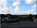
Bennett Avenue
Small road linking Woodland Avenue and Bennett Drive. The land is climbing out of the former Goldstone Bottom here and the views can be seen over to the other side of the dry valley. The road was developed in the late 1950s, early 1960s.
Image: © Simon Carey
Taken: 18 Jan 2009
0.03 miles
2
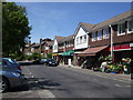
Shops in Woodland Drive
near the junction with Goldstone Crescent
Image: © Paul Gillett
Taken: 22 May 2010
0.03 miles
3
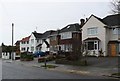
Woodland Drive
The houses in this area tend to be large detached family houses. Woodland Drive is a medium sized through route between the A2023 Nevill Road and Dyke Road Avenue.
Image: © Nigel Mykura
Taken: 13 Feb 2011
0.03 miles
4
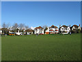
Goldstone Crescent from Hove Park
Hove Park was laid out in 1905 having been acquired from the Nevill family with the proviso that they could develop a road on the eastern side when they wished. The road had a name by 1911 but no buildings, these had to wait until the 1920s and '30s though this section was filled intermittently. The house in the middle has recently been converted from a bungalow.
Image: © Simon Carey
Taken: 18 Jan 2009
0.04 miles
5
Woodland Drive
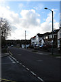
Taken from the junction with Bennett Avenue looking towards the crossroads with Goldstone Crescent. One of the more upmarket roads in the city which began development in the late 1930s and continued after the war. The speed humps gives a clue that this road can be a bit of a rat run.
Image: © Simon Carey
Taken: 18 Jan 2009
0.04 miles
7
Bennett Drive
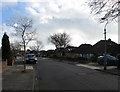
The road links Shirley Drive with Woodruff Avenue and was developed during the 1950s.
Image: © Simon Carey
Taken: 18 Jan 2009
0.06 miles
8
Woodland Drive
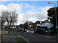
Road linking Nevill Road, the A2023, and Dyke Road Avenue near the junction with the A27, and consequently a bit of a rat run, hence the speed humps that are evident along the length of the road. Developed in the late 1930s and continued after the war this is one of Brighton and Hove's more upmarket residential areas.
Image: © Simon Carey
Taken: 18 Jan 2009
0.07 miles
9
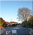
Goldstone Crescent, Hove
A view across the junction with Woodland Drive at the northern point of Hove Park.
Image: © Simon Carey
Taken: 15 Apr 2020
0.07 miles
10
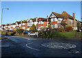
Goldstone Crescent
Viewed from the junction with Woodland Drive and having followed the eastern side of what was once Goldstone Bottom it now descends to run along the former valley floor for the rest of its course. The path on the right is the start of a bridleway that goes to Red Hill and Dyke Road. It connects Old Shoreham Road, the A270, with King George VI Avenue, the A2038, and consequently has been known to have been a bit of a rat run though this has lessened since the building of the bypass. As part of the deal in buying the land for Hove Park, the Nevill family had an option to develop what was soon known as Goldstone Crescent being marked as such on 1911 map. However, development was taken up until the 1920s and most of the length of road had been built upon by the end of the 1930s.
Image: © Simon Carey
Taken: 18 Jan 2009
0.09 miles