
IMAGES TAKEN NEAR TO
Bishops Road, HOVE, BN3 6PN
Introduction
This page details the photographs taken nearby to Bishops Road, BN3 6PN by members of the Geograph project.
The Geograph project started in 2005 with the aim of publishing, organising and preserving representative images for every square kilometre of Great Britain, Ireland and the Isle of Man.

There are currently over 7.5m images from over14,400 individuals and you can help contribute to the project by visiting https://www.geograph.org.uk
Image Map
Images are licensed for reuse under creativecommons.org/licenses/by-sa/2.0
Notes
- Clicking on the map will re-center to the selected point.
- The higher the marker number, the further away the image location is from the centre of the postcode.
Image Listing (61 Images Found)
Images are licensed for reuse under creativecommons.org/licenses/by-sa/2.0
Image
Details
Distance
1
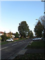
Shirley Drive
The main arterial road for this area Hove, a continuation of Grand Avenue and The Drive that begins on the A259 next to the sea and heads northwards towards Woodland Drive. This section lies between The Droveway and Onslow Road.
Image: © Simon Carey
Taken: 25 Oct 2009
0.05 miles
2
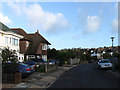
Bishops Road
Residential road linking Woodruff Avenue with Hove Park Road. This looks back towards the junction with the former.
Image: © Simon Carey
Taken: 25 Oct 2009
0.06 miles
3
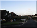
Stanford Close
Small cul-de-sac off Hove Park Way that was developed during the 1950s.
Image: © Simon Carey
Taken: 25 Oct 2009
0.07 miles
4
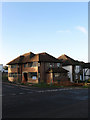
New House, Bishops Road
On the crossroads of that road and The Droveway. Not quite sure if it is new or is being rebuilt or extended.
Image: © Simon Carey
Taken: 25 Oct 2009
0.08 miles
5
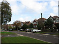
Shirley Drive
The main arterial road for this part of Hove, a continuation of Grand Avenue and The Drive which begins next to the sea and ending at Woodland Drive to the north which feeds onto Dyke Road. Mock tudor aplenty here.
Image: © Simon Carey
Taken: 25 Oct 2009
0.08 miles
6
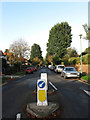
The Droveway
Residential road linking Dyke Road to Goldstone Crescent. As the name suggests the route is much older being the east-west droving route through the village of Preston to West Blatchington and the downland beyond. Still a country track in 1912 it began to be developed once the former downland was acquired by Hove corporation from Preston Rural District Council in 1928. This section looks westwards from the crossroads with Shirley Drive.
Image: © Simon Carey
Taken: 25 Oct 2009
0.09 miles
7
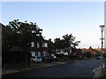
Woodruff Avenue
Residential road linking Goldstone Crescent to Dyke Road and developed from 1928 onwards. This section is opposite the junction with Bennett Drive.
Image: © Simon Carey
Taken: 25 Oct 2009
0.09 miles
8
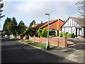
Onslow Road
Residential road that links Dyke Road to Shirley Drive. This section lies between the latter and the crossroads with Mallory Road.
Image: © Simon Carey
Taken: 25 Oct 2009
0.09 miles
9
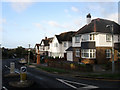
Woodruff Avenue
Residential road linking Goldstone Crescent and Dyke Road. This section is heading south towards the former from the crossroads with Shirley Drive.
Image: © Simon Carey
Taken: 25 Oct 2009
0.10 miles
10
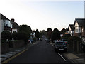
Hove Park Way
Residential street linking Hove Park Road to Woodruff Avenue. This section looks down towards the crossroads with The Droveway.
Image: © Simon Carey
Taken: 25 Oct 2009
0.11 miles