
IMAGES TAKEN NEAR TO
Portland Lane, HOVE, BN3 5SW
Introduction
This page details the photographs taken nearby to Portland Lane, BN3 5SW by members of the Geograph project.
The Geograph project started in 2005 with the aim of publishing, organising and preserving representative images for every square kilometre of Great Britain, Ireland and the Isle of Man.

There are currently over 7.5m images from over14,400 individuals and you can help contribute to the project by visiting https://www.geograph.org.uk
Image Map
Images are licensed for reuse under creativecommons.org/licenses/by-sa/2.0
Notes
- Clicking on the map will re-center to the selected point.
- The higher the marker number, the further away the image location is from the centre of the postcode.
Image Listing (86 Images Found)
Images are licensed for reuse under creativecommons.org/licenses/by-sa/2.0
Image
Details
Distance
1
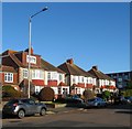
317-327, Portland Road, Aldrington, Hove
Three pairs of semi-detached houses built in the mid 1930s.
Image: © Simon Carey
Taken: 22 Dec 2016
0.05 miles
2
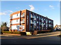
Martello Lofts, Portland Road, Hove
Originally built as offices in the 1970s and for many years home to the local VAT inspectors. These moved out in 2009 and the block continued to be used commercially until 2012. Deemed obsolete for modern office use the block was converted into luxury apartments in 2015, see also Image
The block occupies part of the site of Aldrington Farm which was built sometime in the first third of the 19th century. This was demolished in the 1880s and replaced by an ice factory and later became part of the site of an engineering works before that closed in the 1970s and the site was acquired by Seeboard who demolished the factory and replaced it with offices, see Image
Image: © Simon Carey
Taken: 3 Dec 2016
0.06 miles
3
Portland Road
Portland Road - Portslade towards Hove
Image: © Bob Parkes
Taken: 9 Nov 2007
0.06 miles
4
Glebe Villas, Aldrington, Hove
Built on glebe land belonging to nearby Image the road had been laid out by the 1890s with a few houses built on the eastern side by the turn of the century. Development continued slowly with the western side not completed until the 1930s.
Image: © Simon Carey
Taken: 3 Dec 2016
0.07 miles
5
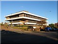
329, Portland Road, Hove
Currently home to EDF customer services who inherited the building from Seeboard who had erected it in 1979. Previously the area was a field called Hog Croft in Aldrington's 1840 tithe map that was located to the immediate west of Aldrington Farm and was not developed until the 1920s when an engineering works was constructed which extended north to the railway. To the south facing onto Portland was a terrace of cottages. The factory closed in the 1970s and the site was acquired by Seeboard.
Image: © Simon Carey
Taken: 3 Dec 2016
0.08 miles
6
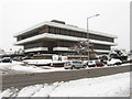
Portland West Building
Currently home to the Hove branch of EDF Energy specifically dealing with customer services. The site was originally a small tools factory until 1975 when it closed and the land was purchased by Seeboard who built the current building and opened it in 1978. It is located on Portland Road.
Image: © Simon Carey
Taken: 2 Dec 2010
0.08 miles
7
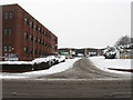
Portland Road Trading Estate
Originally the site of Aldrington Farm it had become an ice works by the 1890s which in turn had disappeared by 1911. By 1932 the area by the railway had become a small works which remained the case until the mid 1970s when the adjacent machine tools factory was closed and the site was purchased by Seeboard. Martello House on the left was built in the mid 1970s and was for many years the local VAT office until its closure in 2009.
Image: © Simon Carey
Taken: 2 Dec 2010
0.08 miles
8
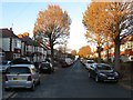
Rothbury Road, Aldrington, Hove
A residential road that heads south from Portland Road joining Jesmond Road at the junction with Mornington Crescent. Once an open space called Old Field according to Aldrington's 1840 tithe map that was not developed along with neighbouring Image until the 1930s.
Image: © Simon Carey
Taken: 3 Dec 2016
0.08 miles
9
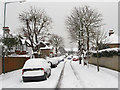
Chelston Avenue
Small dead end residential road running south off Portland Road.
Image: © Simon Carey
Taken: 2 Dec 2010
0.08 miles
10
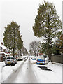
Rothbury Road
Residential street that links Portland Road to Mornington Crescent. Having been covered by 8-10 inches of snow some of the cars have an extra layer of leaves blown off after the snowfall. The street was developed during the 1920s.
Image: © Simon Carey
Taken: 2 Dec 2010
0.10 miles