1
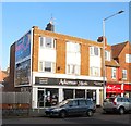
Used Car Dealer, Portland Road
Festooned with billboards and an advert from the pre-decimal age. If only petrol was sixpence today. That at least dates the building to the 1960s.
Image: © Simon Carey
Taken: 2 Dec 2010
0.01 miles
2
163, Portland Road, Aldrington, Hove
See also
Image taken six years ago and the only thing changed is the occupants. The ghost sign that reads 'Petrol save 6d" is still there beneath the billboards.
Image: © Simon Carey
Taken: 17 Dec 2016
0.01 miles
3
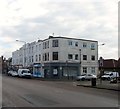
The Stoneham, Portland Road, Aldrington, Hove
Located on the corner of Scott Road which the building predates. Opened in 1896 as the Portland Hotel which was later shortened to the Portland until about five years ago when it was changed to its current name. The building was rebuilt in 1928, see http://regencysociety-jamesgray.com/volume16/source/jg_16_022.html for a view taken in 1911.
Image: © Simon Carey
Taken: 14 Jan 2017
0.02 miles
4
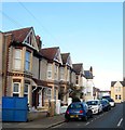
Scott Road, Aldrington, Hove
A short residential street that links Portland Road to Marmion Road that was developed in the first decade of the 20th century. The trees mark the site of Stoneham Park.
Image: © Simon Carey
Taken: 17 Dec 2016
0.02 miles
5
Young Sussex Nursery, Portland Road, Hove
Sandwiched between
Image to the west and
Image to the east the building predates both having been built in 1888 as a school that would become Aldrington Church of England Primary. They continued to operate here until 1990 when a decision to move from what had become a cramped site to newer one in West Blatchington, see
Image The current incumbents, Young Sussex Nursery, opened the following year in 1991.
Image: © Simon Carey
Taken: 17 Dec 2016
0.03 miles
6
186-206, Portland Road, Aldrington, Hove
A set of shops located between Reynolds Road and Titian Road that were built in the mid 1930s as Portland Road became the main shopping hub of the newly constructed estates in the area.
Image: © Simon Carey
Taken: 14 Jan 2017
0.04 miles
7
Hove Drill Hall, Marmion Road, Hove
Appears on the 1911 OS map and built before the rest of the houses to the west of it. Still in use today by both Army Cadets and Hove and Adur Sea cadets.
Image: © Simon Carey
Taken: 2 Oct 2015
0.05 miles
8
Hove Drill Hall
http://www.drillhalls.org/Counties/Sussex/TownHove.htm
Image: © Jim Osley
Taken: 4 Aug 2020
0.05 miles
9
167-185, Portland Road, Aldrington, Hove
A parade of shops built in the mid 1930s on what was former allotment gardens. Beyond is
Image
Image: © Simon Carey
Taken: 17 Dec 2016
0.05 miles
10
Mainstone Road, Aldrington, Hove
A short residential street linking Marmion Road to Stoneham Road that was constructed in the first decade of the 20th century. The road currently consists of three houses on the western side and a warehouse, in the process of being demolished, on the eastern side.
Image: © Simon Carey
Taken: 17 Dec 2016
0.06 miles


