1
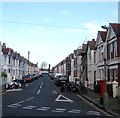
Ruskin Road, Aldrington, Hove
A residential road that heads north from Stoneham Road and ends next to the railway. It was developed around 1902.
Image: © Simon Carey
Taken: 17 Dec 2016
0.02 miles
2
Tamworth Road
In the area known as Poet's Corner due to the street names all being named after poets rather than anything resembling a Bohemian lifestyle. Much of the housing is terraced built for the tradesman who serviced the great and good in the villas between Portland Road and the sea. St Paul's Roman Catholic Church on Portland Road can be seen in the distance.
Image: © Simon Carey
Taken: 14 Jan 2009
0.03 miles
3
Molesworth Street
In the area known as Poet's Corner due to the street names all being named after poets rather than anything resembling a Bohemian lifestyle. Much of the housing is terraced built for the tradesman who serviced the great and good in the villas between Portland Road and the sea. This street links Rutland Road to Tamworth Road.
Image: © Simon Carey
Taken: 14 Jan 2009
0.05 miles
4
Kendal Road, Aldrington, Hove
A residential road that links Stoneham Road to Payne Avenue that was built around 1902.
Image: © Simon Carey
Taken: 17 Dec 2016
0.05 miles
5
Stoneham News, Stoneham Road, Aldrington, Hove
A local newsagent opposite the junction with Ruskin Road. One of the houses on the right has
Image fixed to its southern side.
Image: © Simon Carey
Taken: 22 Jan 2017
0.05 miles
6
A wet day in Kendal Road, Hove
Image: © nick macneill
Taken: 23 Feb 2010
0.05 miles
7
Tamworth Road, Aldrington, Hove
A residential road that heads north from Portland Road ending at the railway that was constructed around 1900. the fence on the left marks the site of Stoneham Park.
Image: © Simon Carey
Taken: 17 Dec 2016
0.05 miles
8
George Payne, Payne Avenue, Aldrington, Hove
A public house located on the corner of Kendal Road that was built around 1901 and originally named the Kendal Arms. The pub was renamed around 2012 in order to distance itself from a poor reputation and reinstate itself as part of the whole community. George Payne was the name of the builder who developed the surrounding area.
Image: © Simon Carey
Taken: 17 Dec 2016
0.05 miles
9
Ruskin Place, Aldrington, Hove
A named path that lies between Tamworth Road and Ruskin Road. The houses were built around 2001 on the site of a former factory occupied by TB Colman & Son who made revolving doors. The company also had another site at
Image
Image: © Simon Carey
Taken: 17 Dec 2016
0.06 miles
10
The George Payne, formerly Kendal Arms
Image: © Alex McGregor
Taken: 13 Aug 2014
0.06 miles


