IMAGES TAKEN NEAR TO
Kingsway, HOVE, BN3 4QW

Introduction

This page details the photographs taken nearby to Kingsway, BN3 4QW by members of the Geograph project.

The Geograph project started in 2005 with the aim of publishing, organising and preserving representative images for every square kilometre of Great Britain, Ireland and the Isle of Man.

There are currently over 7.5m images from over14,400 individuals and you can help contribute to the project by visiting https://www.geograph.org.uk

Image Map


Images are licensed for reuse under creativecommons.org/licenses/by-sa/2.0
Notes
  • Clicking on the map will re-center to the selected point.
  • The higher the marker number, the further away the image location is from the centre of the postcode.

Image Listing (256 Images Found)

Images are licensed for reuse under creativecommons.org/licenses/by-sa/2.0
  • ...
Image
Details
Distance
1
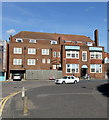
332-334, Kingsway, Aldrington, Hove
Number 332 is home to Miller Bourne architects since 2006 whilst neighbouring 334 is in the process of being converted into something. The building is actually the top floor of the building on the left in Image
Image: © Simon Carey Taken: 22 Dec 2016
0.01 miles
2
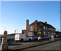
The Gather Inn
Image: © N Chadwick Taken: 4 Jul 2015
0.01 miles
3
Blue Lagoon Bar and B&B. Kingsway, Hove
Image: © PAUL FARMER Taken: 22 Sep 2012
0.01 miles
4
The Gather Inn, Kingsway, Aldrington, Hove
The first pub to appear here was in 1859 when it opened to capitalise on the newly canalized eastern end of Shoreham Harbour. The original building lasted until 1930 when it was rebuilt, see http://regencysociety-jamesgray.com/volume15/source/jg_15_080.html taken in 1927, when it was replaced by the current one. The pub retained the name Adur Hotel until 1997 when it initially became Kingsway 330 (After the official number on the address), then Blue Lagoon before acquiring its current name in 2015. The pub also contains a function room and offers bed and breakfast accommodation. The building itself sits on a former low lying cliff with the southern side extending downwards to Wharf Road, see Image
Image: © Simon Carey Taken: 22 Dec 2016
0.02 miles
5
Vega Building, Kingsway, Aldrington, Hove
Located between Brittany Road and Roman Road the block was completed in 2013 on the site of a former garage that had operated here since the 1930s. The block belongs to a social housing group with the flats only available for rent.
Image: © Simon Carey Taken: 3 Dec 2016
0.02 miles
6
Seafront Apartments (Vega)
Image: © N Chadwick Taken: 4 Jul 2015
0.02 miles
7
Aldrington, Gather Inn
Public house with accommodation on Kingsway. Drinking and eating areas on two levels, with counter right. Sea and lagoon views, outdoor seating, background music. Cask ale on offer: Bath Ales Gem.
Image: © Mike Faherty Taken: 11 Aug 2018
0.02 miles
8
Basin Road North, Aldrington, Hove
Service road that runs between the A259 in the west and Wharf road to the east providing access for the quays on the northern side of Aldrington Basin.
Image: © Simon Carey Taken: 3 Dec 2016
0.02 miles
9
Roman Rd
Image: © N Chadwick Taken: 4 Jul 2015
0.03 miles
10
Wharf Road, Aldrington, Hove
Heading west from the A259 towards the junction with Basin Road South and Basin Road North located to the rear of The Gather Inn public house, the first building on the right. Beyond the hedge to the left is Hove Lagoon.
Image: © Simon Carey Taken: 4 Dec 2016
0.03 miles
  • ...