1
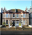
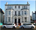
Sackville Gardens, Aldrington, Hove
A resindential road that links Kingsway, the A259, to New Church Road, the B2066. It was laid out in the 1890s had been partially built by the time of the 1898 OS map and completed by the 1911 edition.
Image: © Simon Carey
Taken: 11 Dec 2016
0.01 miles
2
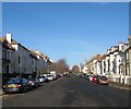
Walsingham Road, Aldrington, Hove
A residential road linking Kingsway, the A259, to New Church Road, the B2066. Laid out in the 1890s it was partially developed by the time of the 1898 OS map and completed by the 1911 edition.
Image: © Simon Carey
Taken: 11 Dec 2016
0.05 miles
3
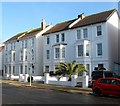
32-34, Walsingham Road, Aldrington, Hove
Part of a group (Numbers 18-48) of semi-detached houses built in the same style along the western side of the road sometime during the first decade of the 20th century.
Image: © Simon Carey
Taken: 11 Dec 2016
0.06 miles
4
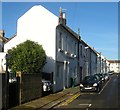
Westbourne Villas, Aldrington, Hove
A residential road that runs between Kingsway, the A259, and New church Road, the B2066. The road was developed in the 1890s with the exception of a couple of small plots at the northern end and are a mixture of two and three storey Victorian houses.
Image: © Simon Carey
Taken: 11 Dec 2016
0.06 miles
5
13-19, Walsingham Road, Aldrington, Hove
The surviving three storey houses at the south eastern end of the road that were built in the 1890s. Numbers 1-11 were lost to the construction of
Image
Image: © Simon Carey
Taken: 11 Dec 2016
0.08 miles
6
5, Sackville Gardens, Aldrington, Hove
Originally a single house built between 1895-98 that has been extended into the roof and converted into flats.
Image: © Simon Carey
Taken: 11 Dec 2016
0.09 miles
7
16-34, Westbourne Place, Aldrington, Hove
A residential road that is located to the east of Westbourne Villas. The small cottages were built in the 1890s.
Image: © Simon Carey
Taken: 11 Dec 2016
0.09 miles
8
1-3, Sackville Gardens, Aldrington, Hove
Located at the southern end of the road and built between 1895-98. Both have been converted into flats.
Image: © Simon Carey
Taken: 11 Dec 2016
0.09 miles
9
Clarke Court, Walsingham Road, Aldrington, Hove
Built in the early 1970s on the site of 1-11 Walsingham Road that had been built in the 1890s and which only
Image survive. See http://regencysociety-jamesgray.com/volume15/source/jg_15_111.html and http://regencysociety-jamesgray.com/volume15/source/jg_15_112.html for images of the former houses taken in 1971 prior to demolition.
Image: © Simon Carey
Taken: 11 Dec 2016
0.10 miles
10
Westbourne Place
A one-way street with two right-angled corners
Image: © Robin Webster
Taken: 23 Mar 2010
0.10 miles


