
IMAGES TAKEN NEAR TO
Kingsway, HOVE, BN3 4FZ
Introduction
This page details the photographs taken nearby to Kingsway, BN3 4FZ by members of the Geograph project.
The Geograph project started in 2005 with the aim of publishing, organising and preserving representative images for every square kilometre of Great Britain, Ireland and the Isle of Man.

There are currently over 7.5m images from over14,400 individuals and you can help contribute to the project by visiting https://www.geograph.org.uk
Image Map
Images are licensed for reuse under creativecommons.org/licenses/by-sa/2.0
Notes
- Clicking on the map will re-center to the selected point.
- The higher the marker number, the further away the image location is from the centre of the postcode.
Image Listing (227 Images Found)
Images are licensed for reuse under creativecommons.org/licenses/by-sa/2.0
Image
Details
Distance
2
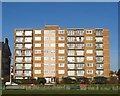
Fairlawns, Kingsway, Hove
The flats were built in the mid 1970s on the site of three former house, numbers 159-163, which had been constructed at the end of the 1920s, see http://regencysociety-jamesgray.com/volume15/source/jg_15_011.html . The gap on the left between the block and neighbouring Image marks the old parish boundary between Hove and Aldrington. Marked as an open field on Hove's 1839 tithe map by the 1878 OS map it was the location of the Mariner's Inn which had disappeared by the 1898 edition after which the area was used as market gardens until finally developed during the 1920s, virtually the seafront area in the parish of Hove to be built.
Image: © Simon Carey
Taken: 11 Dec 2016
0.02 miles
3
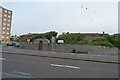
Princes Crescent
The wall is Grade II listed. http://www.britishlistedbuildings.co.uk/en-365556-perimeter-wall-to-no-157-perimeter-wall-
Image: © N Chadwick
Taken: 4 Jul 2015
0.02 miles
4
157, Kingsway, Hove
Located in the oval formed by Princes Crescent. When the road was first developed in the 1920s it was kept as an open space and for a time was used as a putting green. In the late 1930s it was acquired by Ian Millar, a businessman, who employed Robert Cromie to custom build him house. Completed in 1937 it was made from specially made bricks imported from Italy. Millar only lived here for nine years selling out to Hove Hospital in 1946 who converted it into a nurses living accommodation. Further change occurred in 1963 when it became a nurses training school which it remained until 1989 when the local health authority tried and failed to sell it. Eventually it was acquired in 1993 by the Royal Masonic Benevolent Institution who converted it into a care home which opened in 1996 and is now known as Barford Court.
Image: © Simon Carey
Taken: 11 Dec 2016
0.03 miles
5
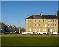
167-171, Kingsway, Aldrington, Hove
Originally known as Westbourne Terrace and located on the corner of Westbourne Villas, the small terrace was built in the 1880s next to the old parish boundary between Hove and Aldrington.
Image: © Simon Carey
Taken: 11 Dec 2016
0.04 miles
7
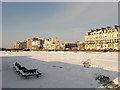
Bowling Green, Western Lawns
Under a carpet of snow after 10cm fell the previous night.
Image: © Simon Carey
Taken: 18 Dec 2009
0.06 miles
9
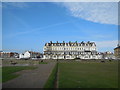
Apartments Hove Kingsway
Viewed from the Western Lawns
Image: © Paul Gillett
Taken: 17 Mar 2014
0.06 miles
10
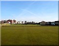
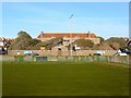
Hove and Kingsway Bowling Club, Hove
Looking across two greens on the Western Lawns with the clubhouse on the right. The current club was established in 1970 though a bowling green was first laid out in the first decade of the 20th century which later grew to four plus an additional croquet lawn. Council cut backs in 2013 mean only three are maintained now.
Image: © Simon Carey
Taken: 11 Dec 2016
0.07 miles