IMAGES TAKEN NEAR TO
New Church Road, HOVE, BN3 4DA
Introduction
This page details the photographs taken nearby to New Church Road, BN3 4DA by members of the Geograph project.
The Geograph project started in 2005 with the aim of publishing, organising and preserving representative images for every square kilometre of Great Britain, Ireland and the Isle of Man.

There are currently over 7.5m images from over14,400 individuals and you can help contribute to the project by visiting https://www.geograph.org.uk
Image Map
Images are licensed for reuse under creativecommons.org/licenses/by-sa/2.0
Notes
- Clicking on the map will re-center to the selected point.
- The higher the marker number, the further away the image location is from the centre of the postcode.
Image Listing (89 Images Found)
Images are licensed for reuse under creativecommons.org/licenses/by-sa/2.0
Image
Details
Distance
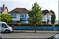
3
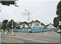
Aldrington, Deepdene School
Independent nursery and preparatory school on New Church Road: https://www.deepdeneschool.com/
Image: © Mike Faherty
Taken: 11 Aug 2018
0.04 miles
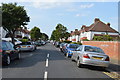
7
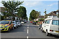
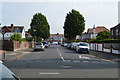
Mornington Crescent, Aldrington, Hove
A residential road that heads north from New Church Road and ends at the junction with Rothbury Road and Jesmond Road. Originally part of an open space called Old Field according to Aldrington's 1840 tithe map that was developed in the 1930s.
Image: © Simon Carey
Taken: 3 Dec 2016
0.06 miles