IMAGES TAKEN NEAR TO
Brooker Street, HOVE, BN3 3YX

Introduction

This page details the photographs taken nearby to Brooker Street, BN3 3YX by members of the Geograph project.

The Geograph project started in 2005 with the aim of publishing, organising and preserving representative images for every square kilometre of Great Britain, Ireland and the Isle of Man.

There are currently over 7.5m images from over14,400 individuals and you can help contribute to the project by visiting https://www.geograph.org.uk

Image Map


Images are licensed for reuse under creativecommons.org/licenses/by-sa/2.0
Notes
  • Clicking on the map will re-center to the selected point.
  • The higher the marker number, the further away the image location is from the centre of the postcode.

Image Listing (180 Images Found)

Images are licensed for reuse under creativecommons.org/licenses/by-sa/2.0
  • ...
Image
Details
Distance
1
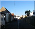
Brooker Street, Hove
A residential street linking Stirling Place to Blatchington Road that was developed in the early 1880s.
Image: © Simon Carey Taken: 18 Feb 2017
0.01 miles
2
Brooker Place, Hove
A cul de sac off Stirling Place which consists largely of garages with the exception of the house at the end. The houses on the right front onto Image
Image: © Simon Carey Taken: 18 Feb 2017
0.02 miles
3
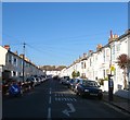
Stirling Place, Hove
A residential street that runs between Belfast Street and Sackville Road, the A2023 that was developed in the early 1880s.
Image: © Simon Carey Taken: 18 Feb 2017
0.05 miles
4
Housing terrace, Stirling Place, Hove
Image: © Jim Osley Taken: 1 Jan 2017
0.05 miles
5
"The Foragers" public house, Hove
Image: © Jim Osley Taken: 1 Jan 2017
0.06 miles
6
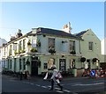
The Foragers, Stirling Place, Hove
Located on the corner of Stirling Place and Connaught Terrace the pub opened as the Stirling Arms in 1884. The name change occurred in 2006.
Image: © Simon Carey Taken: 18 Feb 2017
0.06 miles
7
Blatchington Road, Hove
Image: © nick macneill Taken: 9 Mar 2012
0.06 miles
8
Connaught Terrace, Hove
A residential street linking Stirling Place to Blatchington Road that was developed in the early 1880s.
Image: © Simon Carey Taken: 18 Feb 2017
0.06 miles
9
Pedimented gable, Stirling Place, Hove
Image: © Jim Osley Taken: 1 Jan 2017
0.06 miles
10
Sackville Road, Hove
A terrace of houses north of the junction at Church Road and Hove Street. See Wikipedia entry for Hove: http://en.wikipedia.org/wiki/Hove
Image: © John Fielding Taken: 6 Apr 2011
0.07 miles
  • ...