IMAGES TAKEN NEAR TO
Conway Street, HOVE, BN3 3LT

Introduction

This page details the photographs taken nearby to Conway Street, BN3 3LT by members of the Geograph project.

The Geograph project started in 2005 with the aim of publishing, organising and preserving representative images for every square kilometre of Great Britain, Ireland and the Isle of Man.

There are currently over 7.5m images from over14,400 individuals and you can help contribute to the project by visiting https://www.geograph.org.uk

Image Map


Images are licensed for reuse under creativecommons.org/licenses/by-sa/2.0
Notes
  • Clicking on the map will re-center to the selected point.
  • The higher the marker number, the further away the image location is from the centre of the postcode.

Image Listing (171 Images Found)

Images are licensed for reuse under creativecommons.org/licenses/by-sa/2.0
  • ...
Image
Details
Distance
1
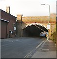
Railway Bridge on Fonthill Road, Hove
High vehicles need to be careful here. The railway overhead is the line between Hove and Southammpton.
Image: © Danny P Robinson Taken: 31 May 2007
0.02 miles
2
Conway Street
Running parallel to the railway which lies to the north. The first omnibus depot arrived in the street when they were still horse drawn during the 1880s and continued their presence through the conversion to motor vehicles. The overnight snow has meant a lot of buses being taken off their routes particularly the more hilly areas of the conurbation. The southern side of the street was cleared of housing during the mid 1960s.
Image: © Simon Carey Taken: 2 Dec 2010
0.02 miles
3
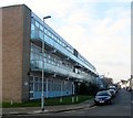
Industrial House, Conway Street, Hove
Home to a number of businesses and located on the corner of Goldstone Street and built in 1970-71, see http://regencysociety-jamesgray.com/volume14/source/jg_14_112.html for a view taken in 1970 from the south. To the right in the distance are Image The building is looking its age and i wouldn't be too surprised if it was replaced in the next few years.
Image: © Simon Carey Taken: 17 Dec 2016
0.03 miles
4
Fonthill Road Railway Bridge
Taken from the crossroads with Conway Street. The buildings either side are part of Brighton & Hove Bus Depot.
Image: © Simon Carey Taken: 14 Oct 2007
0.03 miles
5
Goldstone Street, Hove
The road was laid out in the 1870s and originally ran from Clarendon Villas as far as the railway bridge after which it becomes Fonthill Road. However, major redevelopment between Clarendon Road and the railway line severed the connection south of Ellen Street leaving just this remaining truncated stretch to the bridge. The Conway Street bus depot straddles the road as it approaches the bridge.
Image: © Simon Carey Taken: 22 Jan 2017
0.03 miles
6
Rail Bridge in Newtown Road
The West Coastway rail line crosses the road here just to the west of Hove Station.
Image: © Paul Gillett Taken: 5 Dec 2010
0.04 miles
7
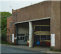
Hove : Brighton & Hove bus depot
Image: © Jim Osley Taken: 3 May 2021
0.04 miles
8
Hove Station
Looking towards the West
Image: © Tom Jolliffe Taken: Unknown
0.05 miles
9
The Agora, Ellen Street
Formerly known as Intek House, it was refurbished around 2004 from a 70s non-descript shabby building to this rather shiny new office block.
Image: © Simon Carey Taken: 14 Jan 2009
0.05 miles
10
Offices of Brighton and Hove Buses
On the corner of Conway Street and Fonthill Road, Hove.
Image: © Danny P Robinson Taken: 31 May 2007
0.05 miles
  • ...