
IMAGES TAKEN NEAR TO
Wilbury Road, HOVE, BN3 3GJ
Introduction
This page details the photographs taken nearby to Wilbury Road, BN3 3GJ by members of the Geograph project.
The Geograph project started in 2005 with the aim of publishing, organising and preserving representative images for every square kilometre of Great Britain, Ireland and the Isle of Man.

There are currently over 7.5m images from over14,400 individuals and you can help contribute to the project by visiting https://www.geograph.org.uk
Image Map
Images are licensed for reuse under creativecommons.org/licenses/by-sa/2.0
Notes
- Clicking on the map will re-center to the selected point.
- The higher the marker number, the further away the image location is from the centre of the postcode.
Image Listing (301 Images Found)
Images are licensed for reuse under creativecommons.org/licenses/by-sa/2.0
Image
Details
Distance
1
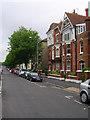
Wilbury Road - Southern End
Looking north from the junction with Church Road. The northern section of the road is mostly in TQ2905.
Image: © Simon Carey
Taken: 1 Jul 2007
0.04 miles
2
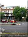
The Ambassadors, Wilbury Road
Early 1960s block of flats on the western side of Wilbury Road. The southern entrance to Wilbury Grove is to the right.
Image: © Simon Carey
Taken: 1 Jul 2007
0.04 miles
3
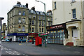
Hove - corner of Church Road and Wilbury Road
The far corner is of Church Road and Second Avenue.
Image: © Robin Webster
Taken: 7 Apr 2010
0.05 miles
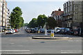
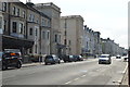
6
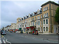
Church Road
Church Road is one of the principal shopping streets of Hove and follows the course of a much older track linking the church with Brighton. The junction with Selbourne Road and First Avenue forms the eastern most part of the shopping area and this view is the northern side between the former and Wilbury Road. Hove Town Hall clock can be seen further down the road. See Image for the view of the opposite of the road.
Image: © Simon Carey
Taken: 1 Jul 2007
0.07 miles
7
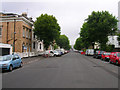
Selbourne Road
This road links Church Road to Eaton Road with the entrance to the Sussex County Cricket Ground just visible at the end of the road. The large leafy avenues are integral to the feel of Hove and gives it a separate identity to that of Brighton.
Image: © Simon Carey
Taken: 1 Jul 2007
0.07 miles
8
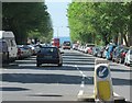
Hove: down to the sea
Blue sky, sea and buses at the end of a foreshortened zoom view down The Drive, taken from Eaton Road on a bright June morning.
Image: © John Sutton
Taken: 1 Jun 2013
0.07 miles
10
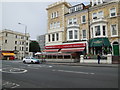
Topolino Italian Restaurant, Hove
Italian Restaurant in Church Road http://www.topolinoduo.co.uk/
Image: © Paul Gillett
Taken: 5 Jul 2013
0.08 miles