
IMAGES TAKEN NEAR TO
Lorna Road, HOVE, BN3 3EN
Introduction
This page details the photographs taken nearby to Lorna Road, BN3 3EN by members of the Geograph project.
The Geograph project started in 2005 with the aim of publishing, organising and preserving representative images for every square kilometre of Great Britain, Ireland and the Isle of Man.

There are currently over 7.5m images from over14,400 individuals and you can help contribute to the project by visiting https://www.geograph.org.uk
Image Map
Images are licensed for reuse under creativecommons.org/licenses/by-sa/2.0
Notes
- Clicking on the map will re-center to the selected point.
- The higher the marker number, the further away the image location is from the centre of the postcode.
Image Listing (213 Images Found)
Images are licensed for reuse under creativecommons.org/licenses/by-sa/2.0
Image
Details
Distance
1
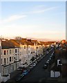
Lorna Road, Hove
On the left are Image whilst beyond are numbers 77-91 which were built in 1880 and originally known as Doone Terrace. Much of the northern part of the road had been built by 1900 the southern side was not completed until the 1930s.
Image: © Simon Carey
Taken: 28 Feb 2016
0.01 miles
2
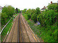
Site of Holland Road Halt
Taken from left hand side of here, Image] this spot marks the site of the former station which was an intermediate stop between Brighton and Hove. The platforms were wooden and access was down a flight of stairs on each side from Holland Road. The station was closed in 1956 and nothing remains of its existence today. The line is the west coast one which links Brighton to Portsmouth and it is joined by the Cliftonville Spur, a link that enables trains to bypass Brighton Station, just behind the flats to the right. The bridge in the distance is this, Image] .
Image: © Simon Carey
Taken: 14 May 2006
0.03 miles
3
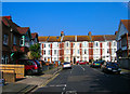
Palmeira Place
Looking towards the junction with Lorna Road.
Image: © Simon Carey
Taken: 15 Oct 2006
0.03 miles
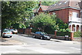
5
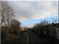
Hove Junction
Looking from Wilbury Villas bridge towards the point where the Cliftonville Spur leaves the West Coastway Line to join with the main London-Brighton line south of Preston Park. This was the first line to built in Sussex connecting Brighton to Shoreham and was opened in 1840, the Cliftonville Spur was added in 1879 to avoid changing at Brighton for those travelling to London.
Image: © Simon Carey
Taken: 14 Jan 2009
0.04 miles
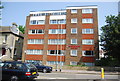
7
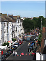
Street Party, Lorna Road
Organised by local residents as a community get together it was first held in 2008 and was successful enough to warrant a follow up in 2009. The stage is in view whilst beyond are tables for the barbecue and out of view is a kids play area. The event runs from late afternoon until about 10.30.
Image: © Simon Carey
Taken: 4 Jul 2009
0.05 miles
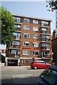
10
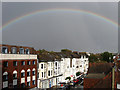
Rainbow over Hove
A very heavy ten minute shower followed by bright sun resulted in this rainbow. Lorna Road is the road just in view.
Image: © Simon Carey
Taken: 1 Sep 2009
0.06 miles