1
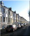
Seafield Rd
Image: © N Chadwick
Taken: 4 Jul 2015
0.03 miles
2
Osborne Villas
Image: © N Chadwick
Taken: 4 Jul 2015
0.04 miles
3
Osborne Villas
Part of the Cliftonville Estate developed in the 1850s.
Image: © Simon Carey
Taken: 1 Jun 2007
0.04 miles
4
St Aubyns
Image: © N Chadwick
Taken: 4 Jul 2015
0.04 miles
5
Osborne Villas, Hove
A residential street that links Kingsway, the A259, to Church Road, the B2066, that was developed in the 1850s.
Image: © Simon Carey
Taken: 18 Feb 2017
0.05 miles
6
Seafield Road, Hove
A residential road connecting Church Road, the B2066, with Kingsway, the A259, that was developed in the 1870s as part of the suburb of Cliftonville. The road is fully developed on the eastern side but contains garages, except for the southern end, on the western side.
Image: © Simon Carey
Taken: 18 Feb 2017
0.06 miles
7
Lych gate, St Andrew's Church
Image: © N Chadwick
Taken: 4 Jul 2015
0.06 miles
8
St Andrew's church, Hove
St Andrew’s was built to serve wealthy society, near a gleaming new estate of terraced mansions by the sea. Set back from the sea front, the Italian Renaissance style and symmetry and grandeur of this 1827 church by the famous architect Sir Charles Barry, matches the neighbouring squares and terraces http://www.visitchurches.org.uk/Ourchurches/Completelistofchurches/St-Andrews-Church-Hove-East-Sussex/#sthash.ZgVS2KQg.dpuf
Image: © Paul Gillett
Taken: 7 Feb 2015
0.06 miles
9
George St
Image: © N Chadwick
Taken: 4 Jul 2015
0.07 miles
10
Headstone for Sir George Everest
Headstone for Sir George Everest and two of his daughters. "In memory of my dearly loved husband George Everest. Died Dec. 1st. 1866, aged 76 years, and of our dear children, Emma Colebrooke, died February 10th. 1852, aged 2 years 10 months, and Benigna Edith, died January 21st. 1860, aged 4 months. Gone but not forgotten." Sir George Everest was born in Gwernwade, near Brecon in Wales, and was educated at various military schools in England. In 1806, he joined the East India Company, and served for the next seven years in Bengal. From 1814 to 1816, he worked on the survey of Java, then returned to India where, until 1841, he worked, with two breaks to recover his health, on the mapping of the sub-continent, rising to the rank of Chief Surveyor. He was made a Fellow of the Royal Societry in 1827, and was knighted in 1861. In 1865, Peak XV of the Himalayas was re-named Mount Everest in his honour. The grave to his left bears the inscription : "In beloved memory of Lucetta Mary Everest. Died January 10th. 1857, aged 69 years." This is the headstone of his sister. A peculiarity is that Sir George never lived in Brighton nor in Hove, and is not known to have had any connection with them. (bio by: Iain MacFarlaine & amended by The Saunterer)
Image: © The Saunterer
Taken: 28 Dec 2013
0.07 miles


