IMAGES TAKEN NEAR TO
Adelaide Crescent, HOVE, BN3 2JJ

Introduction

This page details the photographs taken nearby to Adelaide Crescent, BN3 2JJ by members of the Geograph project.

The Geograph project started in 2005 with the aim of publishing, organising and preserving representative images for every square kilometre of Great Britain, Ireland and the Isle of Man.

There are currently over 7.5m images from over14,400 individuals and you can help contribute to the project by visiting https://www.geograph.org.uk

Image Map


Images are licensed for reuse under creativecommons.org/licenses/by-sa/2.0
Notes
  • Clicking on the map will re-center to the selected point.
  • The higher the marker number, the further away the image location is from the centre of the postcode.

Image Listing (438 Images Found)

Images are licensed for reuse under creativecommons.org/licenses/by-sa/2.0
  • ...
Image
Details
Distance
1
Adelaide Mansions, Hove
Grandiose seafront apartment blocks, with distinctive columns at the entrances and wrought iron balconies above.
Image: © Colin Smith Taken: 31 Jul 2010
0.01 miles
2
Adelaide Mansions
The western side of the part of Adelaide Crescent the faces out onto the beach. Viewed from Brunswick Lawns across the A259.
Image: © Simon Carey Taken: 2 Sep 2007
0.01 miles
3
Adelaide Crescent
Image: © N Chadwick Taken: 4 Jul 2015
0.01 miles
4
Brunswick Square
Image: © N Chadwick Taken: 13 Jul 2013
0.02 miles
5
St Johns Road
The road lies between First Avenue and Palmerira Square/Adelaide crescent and was built as a service road for the latter which means it is split between residential properties and workshops and garages. The pavement is actually marked out on the road.
Image: © Simon Carey Taken: 1 Feb 2014
0.02 miles
6
Adelaide Mansions
Grade II http://www.britishlistedbuildings.co.uk/en-365557-adelaide-mansions-
Image: © N Chadwick Taken: 13 Jul 2013
0.02 miles
7
St John's Rd
Image: © N Chadwick Taken: 13 Jul 2013
0.02 miles
8
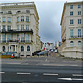
Hove: stucco and a distant spire
Looking from the seafront up St John's Road towards St John's Church (1852-4) on a cloudy April morning.
Image: © John Sutton Taken: 8 Apr 2022
0.02 miles
9
Adelaide Crescent
The western side of Adelaide Crescent, part of a grand development off Kingsway originally designed by Decimus Burton in 1830 but with only limited development initially, with final construction to an altered design (including this part) not taking place until 1850-60. The two sides are both Grade II* listed, but separately - for this, the western, side see https://historicengland.org.uk/listing/the-list/list-entry/1187537?section=official-listing.
Image: © Ian Capper Taken: 21 Jan 2022
0.02 miles
10
West Side of Adelaide Crescent
Image: © Paul Gillett Taken: 17 Dec 2011
0.02 miles
  • ...