1
Lyons Close
Home to the Peacock Industrial Constructed opened in the 1980s on the site of a former railway coal yard. Allied Carpets has recently gone into administration so it will be interesting to see whether they remain here.
Image: © Simon Carey
Taken: 20 Jul 2009
0.02 miles
2
Lyon Close
Small industrial estate built on the site of a former coal depot and siding.
Image: © Simon Carey
Taken: 18 Dec 2009
0.02 miles
3
Peacock Industrial Estate
Flotsam and Jetsam between two of the warehouses with the roofs of the houses in Lyndhurst Road in the background.
Image: © Simon Carey
Taken: 6 Apr 2008
0.02 miles
4
Lloyds TSB Building, Davigdor Road
Looking at the eastern side with the Chichester Diocesan Housing Association and Preece House reflected in the glass.
Image: © Simon Carey
Taken: 6 Apr 2008
0.02 miles
5
West Coastway Line from Holland Bridge
The industrial estate to the left was once sidings for a coal yard. They were closed in the early 1970s and the Peacock Industrial estate built on them.
Image: © Simon Carey
Taken: 3 Sep 2006
0.03 miles
6
Lloyds TSB Building, Davigdor Road
Office building used by Lloyds most likely as computer storage as very few people are ever seen going in or out. The large roof to the right is this
Image] whilst the white buildings reflected on the left hand side of the building is on the left hand side of this
Image Lyon Close leads to the Peacock Industrial Estate built on a former coal yard rail siding.
Image: © Simon Carey
Taken: 16 Apr 2006
0.03 miles
7
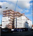
121-123, Davigdor Road, Hove
A block of flats under construction on the corner of Lyon Close. The previous building was a former office block; see
Image
Image: © Simon Carey
Taken: 27 Oct 2017
0.03 miles
8
Wickes, Peacock Industrial Estate
The builders merchants lie in what was once a railway coal siding with just the arches beyond the store a reminder of its former usage.
Image: © Simon Carey
Taken: 14 Aug 2011
0.04 miles
9
Hove 1st railway station (site), Sussex
Opened in 1840 by the London & Brighton Railway on what is today the line from Brighton to Portsmouth, this station closed in 1880.
View east towards Brighton. After closure to passengers, this site was used as a goods station until the 1970s. The original station building would have been where the small tree now is.
Image: © Nigel Thompson
Taken: 13 Jul 2021
0.05 miles
10
Priors House
Office block located on Davigdor Road and viewed from the junction with Somerhill Road. The smaller white building belongs to the Chichester Diocesan Housing Association.
Image: © Simon Carey
Taken: 20 Jul 2009
0.06 miles


