1
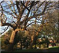
Well in St Ann's well gardens
Image: © Paul Gillett
Taken: 21 Sep 2017
0.01 miles
2
Playground, St Anne's Well Park
This is the start point of a tour of grid Square TQ3004 which covers the western part of central Brighton. Here though we are in Hove and to continue on the tour press the link on each page to take you to the next picture. http://www.geograph.org.uk/photo/211392
Image: © Simon Carey
Taken: 30 Jul 2006
0.01 miles
3
Furze Hill
A road through the former Wick Estate connecting Lansdowne Road with York Avenue. The part of the building on the right is Wick Hall with the more modern Furze Hill Court further up the hill.
Image: © Simon Carey
Taken: 21 Oct 2007
0.01 miles
4
Furze Hill
Running through what was once the grounds of Wick Manor, it links York Avenue with Lansdowne Road. Furze Hill Court is on the immediate left followed by Wick Hall whilst Furze Croft is in the distance on the right.
Image: © Simon Carey
Taken: 2 Feb 2009
0.03 miles
5
Entrance, St Ann's Well Gardens
Southern entrance from Furze Hill. See http://www.mybrightonandhove.org.uk/page_id__7600_img__10104_path__0p114p127p1380p.aspx for a 1912 view.
Image: © Simon Carey
Taken: 21 Oct 2007
0.04 miles
6
Snowwoman, St Ann's Well Gardens
Furze Hill House is in the background.
Image: © Simon Carey
Taken: 6 Apr 2008
0.04 miles
7
St Ann's Well Garden, Hove
Following a path on the eastern wooded side. the path leads to Nizells Avenue passing the children's playground on the way.
Image: © Simon Carey
Taken: 27 Oct 2017
0.04 miles
8
St Ann's Well Garden, Hove
In the more wooded eastern part of the popular park.
Image: © Simon Carey
Taken: 27 Oct 2017
0.04 miles
9
Former Chalybeate, St Ann's Well Gardens
A spring has existed here for many centuries and was non-descript until the 18th century when the water table rose and the water emerged with greater force. Local entrepreneurs set up a spa and the place prospered until the waters began diminishing in the 19th century. The stream is often difficult to see in most seasons, however, today's snow has enabled a greater contrast and highlighted the rusty red colour of the trickle of water.
Image: © Simon Carey
Taken: 18 Jan 2013
0.04 miles
10
Snowdrops in St Ann's Wells Gardens
Image: © Paul Gillett
Taken: 10 Mar 2015
0.05 miles


