IMAGES TAKEN NEAR TO
Queens Park Road, BRIGHTON, BN2 9ZA

Introduction

This page details the photographs taken nearby to Queens Park Road, BN2 9ZA by members of the Geograph project.

The Geograph project started in 2005 with the aim of publishing, organising and preserving representative images for every square kilometre of Great Britain, Ireland and the Isle of Man.

There are currently over 7.5m images from over14,400 individuals and you can help contribute to the project by visiting https://www.geograph.org.uk

Image Map


Images are licensed for reuse under creativecommons.org/licenses/by-sa/2.0
Notes
  • Clicking on the map will re-center to the selected point.
  • The higher the marker number, the further away the image location is from the centre of the postcode.

Image Listing (225 Images Found)

Images are licensed for reuse under creativecommons.org/licenses/by-sa/2.0
  • ...
Image
Details
Distance
1
Clouds over Queens Park Road
Image: © Tufty Taken: 17 Jan 2010
0.01 miles
2
Queen's Park Rd
Image: © N Chadwick Taken: 7 Jul 2018
0.01 miles
3
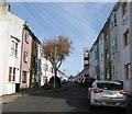
Queen's Park Road, Brighton
A residential road and local arterial route for those wishing to travel from the seafront to Elm Grove. Built in stages from the 1880s onwards.
Image: © Simon Carey Taken: 25 Oct 2015
0.02 miles
4
Londis, Queen's Park Rd
Image: © N Chadwick Taken: 7 Jul 2018
0.03 miles
5
Queens Park Road, unusual colour sky
It is 3.45pm and the sky has been unusually dark despite no rain It is thought the remnants of Hurricane Ophelia dragged tropical air and dust from the Sahara, which turned the sky a strange red. It was so dark in Brighton and Hove that streetlights switched on, with automatic sensors thinking it was nighttime http://www.theargus.co.uk/news/15599879.Red_sky_leaves_onlookers_in_awe/
Image: © Paul Gillett Taken: 16 Oct 2017
0.03 miles
6
St Luke's Terrace
Image: © N Chadwick Taken: 7 Jul 2018
0.04 miles
7
Bentham Rd
Image: © N Chadwick Taken: 7 Jul 2018
0.04 miles
8
Whichelo Place, Brighton
A residential street that runs from Islingwood Road to Bentham Road that was developed in the late 1860s. The two storey number 1 on the left was once a beer house called the Whichelo Arms.
Image: © Simon Carey Taken: 25 Oct 2015
0.04 miles
9
Islingwood Place, Brighton
A residential street that runs between bentham Road and Islingwood Road that was developed in the late 1860s.
Image: © Simon Carey Taken: 25 Oct 2015
0.04 miles
10
Queen's Park Road, Brighton
Queen's Park Road in the suburbs of Brighton.
Image: © Malc McDonald Taken: 24 Aug 2019
0.05 miles
  • ...