1
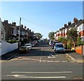
St Luke's School
The evening sunshine brings out the colours.
St Luke's School is a striking building in St Luke's Terrace, located in the Queen's Park area of Brighton. It was built in 1903 to the design of prestigious local architect for the Brighton and Preston School Board, Thomas Simpson. http://www.stlukes.brighton-hove.sch.uk/
Image: © Paul Gillett
Taken: 31 May 2011
0.07 miles
2
Green's, Freshfield Road, Brighton
Bar. Restaurant. Garden. On the corner of Cuthbert Road. Formerly Hemingways, formerly the Cuthbert Arms. Until the proprietor's press statement was found when it was opened as Green's in December 2009, the classification for this was doubtful. He called it a pub, so we will as well.
Image: © Robin Webster
Taken: 30 Apr 2010
0.07 miles
3
Dawson Terrace, Brighton
A residential road that runs from Sutherland Road to Freshfield Road that was developed around 1910.
Image: © Simon Carey
Taken: 11 Oct 2015
0.08 miles
4
Barry Walk, Brighton
This house built in 1968 was on first phase of development on the site of the old Xaverian College, the college itself was not demolished until a few years later.
Image: © Josie Campbell
Taken: 13 Jan 2007
0.09 miles
5
Freshfield Road, BN2
Image: © Mike Quinn
Taken: 20 Apr 2012
0.09 miles
6
Whitehawk Hill Transmitter, Brighton
This lies on the eastern edge of the square, the photo was taken looking pretty much due south.
Image: © JF
Taken: 1 Aug 2005
0.09 miles
7
Queen's Park, Brighton.
A beautiful and very popular breathing space in this busy town.
Image: © Bob Embleton
Taken: 9 Sep 2005
0.09 miles
8
Garden Temple, Attree Villa, Queens Park, Brighton
One of the few remains of Attree Villa. Tucked away on the far side of West Drive opposite the Cam Court flats stands the villa's garden temple, an Italianate, rectangular structure with Ionic pillars which formerly contained the statue of a seated dog.
http://www.mybrightonandhove.org.uk/page_id__8547_path__0p115p203p818p.aspx
Image: © Bob Embleton
Taken: 9 Sep 2005
0.09 miles
9
The Pepper Box at the top of Tower Road, Brighton.
Local legend claimed that if you ran round it seven times a witch would come out!
It's not quite clear why it was built. It may have been a water or observation tower for the Attree Villa which was in the park. It has also been used for printing and publishing the Brighton Daily Mail; as an observation tower in WW2; a scout headquarters; an artist's studio and finally as a public convenience. Today it is not used at all.
http://www.mybrightonandhove.org.uk/page_id__8547_path__0p115p203p818p.aspx
http://www.mybrightonandhove.org.uk/page_id__6325.aspx
Image: © Bob Embleton
Taken: 9 Sep 2005
0.09 miles
10
Trees in Queens Park
viewed from North Drive
Image: © Paul Gillett
Taken: 31 Jul 2010
0.10 miles


