IMAGES TAKEN NEAR TO
Queens Park Terrace, BRIGHTON, BN2 9YB
Introduction
This page details the photographs taken nearby to Queens Park Terrace, BN2 9YB by members of the Geograph project.
The Geograph project started in 2005 with the aim of publishing, organising and preserving representative images for every square kilometre of Great Britain, Ireland and the Isle of Man.

There are currently over 7.5m images from over14,400 individuals and you can help contribute to the project by visiting https://www.geograph.org.uk
Image Map
Images are licensed for reuse under creativecommons.org/licenses/by-sa/2.0
Notes
- Clicking on the map will re-center to the selected point.
- The higher the marker number, the further away the image location is from the centre of the postcode.
Image Listing (170 Images Found)
Images are licensed for reuse under creativecommons.org/licenses/by-sa/2.0
Image
Details
Distance
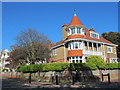
1
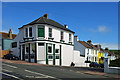
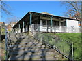
Green's, Freshfield Road, Brighton
Bar. Restaurant. Garden. On the corner of Cuthbert Road. Formerly Hemingways, formerly the Cuthbert Arms. Until the proprietor's press statement was found when it was opened as Green's in December 2009, the classification for this was doubtful. He called it a pub, so we will as well.
Image: © Robin Webster
Taken: 30 Apr 2010
0.06 miles
2
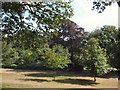
Trees in Queens Park
viewed from North Drive
Image: © Paul Gillett
Taken: 31 Jul 2010
0.08 miles
4
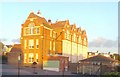
St Luke's School
The evening sunshine brings out the colours.
St Luke's School is a striking building in St Luke's Terrace, located in the Queen's Park area of Brighton. It was built in 1903 to the design of prestigious local architect for the Brighton and Preston School Board, Thomas Simpson. http://www.stlukes.brighton-hove.sch.uk/
Image: © Paul Gillett
Taken: 31 May 2011
0.08 miles
5
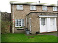
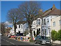
Barry Walk, Brighton
This house built in 1968 was on first phase of development on the site of the old Xaverian College, the college itself was not demolished until a few years later.
Image: © Josie Campbell
Taken: 13 Jan 2007
0.08 miles
6
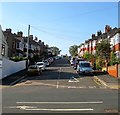
Dawson Terrace, Brighton
A residential road that runs from Sutherland Road to Freshfield Road that was developed around 1910.
Image: © Simon Carey
Taken: 11 Oct 2015
0.08 miles
8
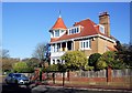
House in East Drive
opposite Queens Park
Image: © Paul Gillett
Taken: 11 Nov 2012
0.09 miles
9
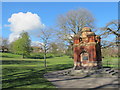
The northern part of Queen's Park (2)
Shows the location of Image
Image: © Mike Quinn
Taken: 20 Apr 2012
0.09 miles