IMAGES TAKEN NEAR TO
Carlyle Street, BRIGHTON, BN2 9XU
Introduction
This page details the photographs taken nearby to Carlyle Street, BN2 9XU by members of the Geograph project.
The Geograph project started in 2005 with the aim of publishing, organising and preserving representative images for every square kilometre of Great Britain, Ireland and the Isle of Man.

There are currently over 7.5m images from over14,400 individuals and you can help contribute to the project by visiting https://www.geograph.org.uk
Image Map
Images are licensed for reuse under creativecommons.org/licenses/by-sa/2.0
Notes
- Clicking on the map will re-center to the selected point.
- The higher the marker number, the further away the image location is from the centre of the postcode.
Image Listing (172 Images Found)
Images are licensed for reuse under creativecommons.org/licenses/by-sa/2.0
Image
Details
Distance
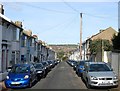
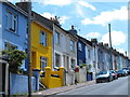
1
Arnold Street, Brighton
A residential street that runs between Queen's Park Road and Elm Grove that was developed in the early 1880s.
Image: © Simon Carey
Taken: 25 Oct 2015
0.02 miles
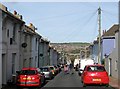
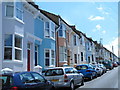
2
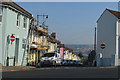
Carlyle Street, Brighton
A residential street that runs between Queen's Park Road and Elm Grove that was developed in the early 1880s.
Image: © Simon Carey
Taken: 25 Oct 2015
0.02 miles
3
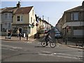
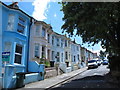
Arnold Street
Side Street between Queens park road and Elm Grove, like many in the area it is hilly and narrow, the cyclist passing the road highlights the steepness of Elm Grove
The Off Licence used to include a sub Post Office until it was closed in 2008
Image: © Paul Gillett
Taken: 18 Apr 2010
0.04 miles
4
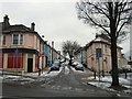
Bentham Road
Photo following the first snow of the winter. Bentham Road runs between Elm Grove and Queens Park Road
Image: © Paul Gillett
Taken: 5 Feb 2012
0.04 miles
7
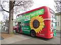
Green Party Bus
Parked in Elm Grove on Polling Day 2015, Green MP Caroline Lucas retained the Brighton Pavilion seat with an increased majority
Image: © Paul Gillett
Taken: 7 May 2015
0.06 miles
10
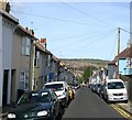
Lynton Street, Brighton
A residential road that runs between Queen's Park Road and Elm Grove that was developed in the early 1880s. Hollingbury Castle can be seen on the Downs in the distance.
Image: © Simon Carey
Taken: 25 Oct 2015
0.06 miles