IMAGES TAKEN NEAR TO
Islingword Road, BRIGHTON, BN2 9SW

Introduction

This page details the photographs taken nearby to Islingword Road, BN2 9SW by members of the Geograph project.

The Geograph project started in 2005 with the aim of publishing, organising and preserving representative images for every square kilometre of Great Britain, Ireland and the Isle of Man.

There are currently over 7.5m images from over14,400 individuals and you can help contribute to the project by visiting https://www.geograph.org.uk

Image Map


Images are licensed for reuse under creativecommons.org/licenses/by-sa/2.0
Notes
  • Clicking on the map will re-center to the selected point.
  • The higher the marker number, the further away the image location is from the centre of the postcode.

Image Listing (299 Images Found)

Images are licensed for reuse under creativecommons.org/licenses/by-sa/2.0
  • ...
Image
Details
Distance
1
Park Crescent, Brighton
Viewed from near the bottom of Elm Grove
Image: © Paul Gillett Taken: 16 Dec 2012
0.01 miles
2
Elm Grove, Brighton
Image: © Malc McDonald Taken: 14 Sep 2014
0.03 miles
3
Bottom of Elm Grove
At the Junction with Lewes Road. The Racehill Inn is visible for the first time in over a year having undergone major refurbishment and been covered with scaffolding
Image: © Paul Gillett Taken: 5 Dec 2010
0.03 miles
4
Racehill Inn
IN lewes Road at the bottom of Elm Grove, the pub has been closed for over a year for major refurbishment, this was the first time for ages that I have seen it without scaffolding
Image: © Paul Gillett Taken: 5 Dec 2010
0.03 miles
5
Park Crescent Health Centre, Lewes Road, BN2
Image: © Mike Quinn Taken: 25 Jun 2014
0.03 miles
6
1, Hanover Crescent
At the entrance to the crescent, opposite the level
Image: © Paul Gillett Taken: 10 Nov 2012
0.03 miles
7
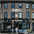
The Admiral
Image: © Ian Hawfinch Taken: 15 Feb 2024
0.03 miles
8
Mason's Deli
Situated at the bottom of Elm Grove, this location was a public convenience before the council closed them in the 1980's, for several years a florist stood on this site called "Flowers at your convenience" Mason's Deli was opened in May 2011
Image: © Paul Gillett Taken: 30 Jun 2011
0.03 miles
9
Park Crescent, BN2
The Wiki entry for Park Crescent http://en.wikipedia.org/wiki/Park_Crescent,_Brighton says that "Park Crescent is a mid-19th-century residential development in the Round Hill area. The horseshoe-shaped, three-part terrace of 48 houses was designed and built by one of Brighton's most important architects, Amon Henry Wilds; he used the Italianate style rather than his (and Brighton's) more common Regency motifs". Numbers 1-16, 17-24 and 33-48 are Grade II listed http://list.english-heritage.org.uk/results.aspx, as are the piers of the Image
Image: © Mike Quinn Taken: 25 Jun 2014
0.04 miles
10
Park Crescent, BN2 (2)
See Image
Image: © Mike Quinn Taken: 25 Jun 2014
0.04 miles
  • ...