IMAGES TAKEN NEAR TO
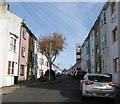
Beaufort Terrace, BRIGHTON, BN2 9SU

Introduction

This page details the photographs taken nearby to Beaufort Terrace, BN2 9SU by members of the Geograph project.

The Geograph project started in 2005 with the aim of publishing, organising and preserving representative images for every square kilometre of Great Britain, Ireland and the Isle of Man.

There are currently over 7.5m images from over14,400 individuals and you can help contribute to the project by visiting https://www.geograph.org.uk

Image Map


Images are licensed for reuse under creativecommons.org/licenses/by-sa/2.0
Notes
  • Clicking on the map will re-center to the selected point.
  • The higher the marker number, the further away the image location is from the centre of the postcode.

Image Listing (268 Images Found)

Images are licensed for reuse under creativecommons.org/licenses/by-sa/2.0
  • ...
Image
Details
Distance
1
Beaufort Terrace, Brighton
A cul de sac off Islingwood Road that was developed in the 1870s opposite a Victorian covered reservoir still in use today.
Image: © Simon Carey Taken: 25 Oct 2015
0.00 miles
2
The Patch - Islingword Road
Popular open area in the middle of the Hanover area
Image: © Paul Gillett Taken: 19 May 2011
0.02 miles
3
Eco-house, Whichelo Place
Seen during the annual heritage open days which included 13 eco houses. The house was built in 2007 built on a confined triangular site to the back of houses on Whichelo Place, Islingwood Road and Beaufort Terrace. It is set down low with a flat roof and roof lights to avoid overlooking to and from the surrounding houses. It is constructed in a timber frame with a lime render and East Sussex chestnut cladding, insulated with sheeps wool, and with a sedum roof with solar water heating.
Image: © Oast House Archive Taken: 11 Sep 2011
0.02 miles
4
Whichelo Place, Brighton
A residential street that runs from Islingwood Road to Bentham Road that was developed in the late 1860s. The two storey number 1 on the left was once a beer house called the Whichelo Arms.
Image: © Simon Carey Taken: 25 Oct 2015
0.03 miles
5
Whichelo Place
Colourful residential terrace.
Image: © Oast House Archive Taken: 11 Sep 2011
0.03 miles
6
Islingword Road
Image: © Oast House Archive Taken: 11 Sep 2011
0.04 miles
7
Whichelo Place, Brighton
Whichelo Place is a residential street in the suburbs of Brighton.
Image: © Malc McDonald Taken: 24 Aug 2019
0.04 miles
8
The Constant Service
Harvey's of Lewes pub.
Image: © Oast House Archive Taken: 5 Nov 2017
0.05 miles
9
The Constant Service sign
Sign for Image], Harvey's of Lewes pub.
Image: © Oast House Archive Taken: 5 Nov 2017
0.05 miles
10
77 Cobden Road, Brighton
Located on the corner of Islingwood Road are the former Cobden Road Slipper Baths that opened in 1894 and closed in 1976. Slipper baths were erected, often in poor areas, to allow locals the luxury of a hot bath, a facility their houses often lacked. These became an anachronism from the 1950s onwards as new houses were suitably plumbed and older housing converted. After closure the building became a community until 1982 and were converted into flats in 1985-86.
Image: © Simon Carey Taken: 25 Oct 2015
0.05 miles
  • ...