1
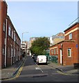
Ivory Place, Brighton
A cul de sac off Morley Street that was developed in the early 1820s and soon became an area of slum housing. The southern end was cleared in the 1930s with threst following in the 1950s and 60s.
Image: © Simon Carey
Taken: 4 Oct 2015
0.03 miles
2
Ashton Rise, Brighton
A road that runs from John Street to the junction with Richmond Parade where it becomes
Image Developed from the late 1950s onwards when much of the area was cleared of former slum housing eradicating a number of roads; Claremont Street, Claremont Row and Claremont Place in the process. The streets were replaced by high rises with three in view from right to left being Saxonbury, Courtlands and Ecclesden. On the left hand side down the slope is Ebenezer Apartments.
Image: © Simon Carey
Taken: 25 Oct 2015
0.03 miles
3
Albion Street
Head west down Richmond Parade then north along Albion Street. Another street that has been extensively redeveloped and as such has become largely anonymous. The dental and doctor's surgeries to the right occupy the site of the old Albion Brewery from which the street was named.
Click on the link to take you to the next page. http://www.geograph.org.uk/photo/231518
Image: © Simon Carey
Taken: 1 Sep 2006
0.04 miles
4
Ebeneezer Baptist Chapel, Richmond Parade
Head north along Ashton Rise then south down Richmond Parade. The latter is the former western section of Richmond Street from which it is now cut off from. The chapel was rebuilt in the late 1960s to replace the previous building which had stood on the opposite side of the road from 1825 to 1866. This area was cleared from 1959 onwards and resulted in the construction of five tower blocks as replacements.
Click on the link to take you to the next page. http://www.geograph.org.uk/photo/231516
Image: © Simon Carey
Taken: 1 Sep 2006
0.04 miles
5
Runners enter Grand Parade
after 4.5 miles of the inaugural Brighton Marathon
Image: © Paul Gillett
Taken: 18 Apr 2010
0.04 miles
6
Keep to Nearside
Side prompting those participating in the Veteran car run to keep to the left hand lane, though most ignored it.
Image: © Oast House Archive
Taken: 4 Nov 2012
0.04 miles
7
Grove Bank, Grove Hill, Brighton
A low rise block of flats that were built in the 1960s as part of the large scale redevelopment of the Albion Hill area which removed many former early 19th century slum properties. Grove bank was located on a former row houses that lined the eastern side of Richmond Buildings, another road eradicated in the clearances. Beyond is the high rise block Thorndale.
Image: © Simon Carey
Taken: 25 Oct 2015
0.05 miles
8
Club Facade in Morley Street, Brighton
Image: © tristan forward
Taken: 9 Nov 2005
0.05 miles
9
Richmond Heights and Normanhurst
Head south down Grove Hill a little way to the next blocks. Richmond Heights to the right and Normanhurst to the left. Built on the site of Cambridge and Ashton Street.
Click on the link to take you to the next page. http://www.geograph.org.uk/photo/231606
Image: © Simon Carey
Taken: 1 Sep 2006
0.05 miles
10
Cranbrook
Head south down Grove Hill then east up a footpath that roughly follows the course of Richmond Street then south down John Street. The tower block in the background is Normanhurst. John Street follows the course of what was once Sussex Terrace. The latter was earmarked for clearance in the 1930s but the war prevented though the council was inadvertently assisted by the Luftwaffe who bombed this area heavily. The clearances recommenced from 1959 and the flats and tower blocks went up in the 1960s.
Click on the link to take you to the next page. http://www.geograph.org.uk/photo/231610
Image: © Simon Carey
Taken: 1 Sep 2006
0.05 miles


