IMAGES TAKEN NEAR TO
Albion Hill, BRIGHTON, BN2 9NW

Introduction

This page details the photographs taken nearby to Albion Hill, BN2 9NW by members of the Geograph project.

The Geograph project started in 2005 with the aim of publishing, organising and preserving representative images for every square kilometre of Great Britain, Ireland and the Isle of Man.

There are currently over 7.5m images from over14,400 individuals and you can help contribute to the project by visiting https://www.geograph.org.uk

Image Map


Images are licensed for reuse under creativecommons.org/licenses/by-sa/2.0
Notes
  • Clicking on the map will re-center to the selected point.
  • The higher the marker number, the further away the image location is from the centre of the postcode.

Image Listing (345 Images Found)

Images are licensed for reuse under creativecommons.org/licenses/by-sa/2.0
  • ...
Image
Details
Distance
1
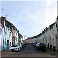
Albion Hill, Brighton
Looking eastwards from the junction with Grove Street. This section of the road was developed from the 1860s on the northern side and 1890s to the south. The road itself is one of the steepest in the city and links Albion Street to Queen's Park Road.
Image: © Simon Carey Taken: 25 Oct 2015
0.01 miles
2
Scotland Street
Head a little west down Southover Street then south down Scotland Street. This is from the southern end and again highlights the multi-coloured facades of the terraces in the area. In fact the gentleman up the ladder is in the process of repainting his. This street was developed between 1859-64. Click on the link to take you to the next page. http://www.geograph.org.uk/photo/232009
Image: © Simon Carey Taken: 1 Sep 2006
0.01 miles
3
Albion Hill
Image: © Oast House Archive Taken: 4 Nov 2012
0.02 miles
4
Albion Hill, Brighton
Taken from about half way up the hill.
Image: © Slbs Taken: 14 Jun 2008
0.03 miles
5
Quebec Street, Brighton
A residential street that runs between Albion Hill and Southover Street that was built in the late 1860s. Like much of the Hanover district parking is a problem on the narrow streets.
Image: © Simon Carey Taken: 1 Nov 2015
0.04 miles
6
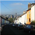
Albion Hill, Brighton
The opposite view of Image looking out over St Bartholomews Church. To its left is the New England Quarter built in the last few years on the former site of Brighton's locomotive works and goods yard.
Image: © Simon Carey Taken: 1 Nov 2015
0.05 miles
7
Montreal Road and Quebec Street
Head east up Southover Street until this roundabout is reached. The two streets were developed between 1865-69 and give an indication how tight the streets are together in this district yet the multi-colour frontages give this area charm. The Canadian connection is completed by the adjoining Toronto Terrace. Click on the link to take you to the next page. http://www.geograph.org.uk/photo/232003
Image: © Simon Carey Taken: 1 Sep 2006
0.05 miles
8
Albion Hill, BN2
Image: © Mike Quinn Taken: 20 Apr 2012
0.05 miles
9
Quebec Street, BN2
Image: © Mike Quinn Taken: 20 Apr 2012
0.05 miles
10
Albion Hill, Brighton - the Montreal Arms
This fine old pub is at the junction of Albion Hill and Montreal Road. The turning further up the hill behind the pub is Toronto Terrace. Canadian cities seem to be a theme running through the street names in this corner of Brighton.
Image: © Slbs Taken: 14 Jun 2008
0.06 miles
  • ...