
IMAGES TAKEN NEAR TO
Belgrave Street, BRIGHTON, BN2 9NS
Introduction
This page details the photographs taken nearby to Belgrave Street, BN2 9NS by members of the Geograph project.
The Geograph project started in 2005 with the aim of publishing, organising and preserving representative images for every square kilometre of Great Britain, Ireland and the Isle of Man.

There are currently over 7.5m images from over14,400 individuals and you can help contribute to the project by visiting https://www.geograph.org.uk
Image Map
Images are licensed for reuse under creativecommons.org/licenses/by-sa/2.0
Notes
- Clicking on the map will re-center to the selected point.
- The higher the marker number, the further away the image location is from the centre of the postcode.
Image Listing (432 Images Found)
Images are licensed for reuse under creativecommons.org/licenses/by-sa/2.0
Image
Details
Distance
1
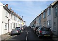
Belgrave Street, Brighton
A residential street that runs between Albion Hill and Southover Street that was developed in the early 1860s.
Image: © Simon Carey
Taken: 25 Oct 2015
0.01 miles
2
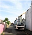
Newark Place, Brighton
A residential street that runs between Albion Hill and Southover Street that was developed in 1859. All dwellings are on the eastern side, the western is made up by the gardens of properties on Belgrave Street.
Image: © Simon Carey
Taken: 25 Oct 2015
0.01 miles
4
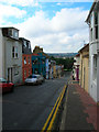
Southover Street
At the northern end of Newark Place look west down Southover Street into the next grid square. The two pubs in view are The Geese (right) and The Greys (left).
Click on the link to take you to the next page. http://www.geograph.org.uk/photo/231987
Image: © Simon Carey
Taken: 1 Sep 2006
0.03 miles
5
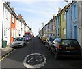
Jersey Street, Brighton
A residential road that runs between Albion Hill and Southover Street that was developed around 1859.
Image: © Simon Carey
Taken: 25 Oct 2015
0.03 miles
6
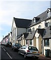
Billam Terrace, Belgrave Street, Brighton
A housing development near the junction with Southover Street that includes the former Belgrave Street Congregational Chapel. The latter was built around 1863 and closed in the 1942 whereupon it became an annex of the Technical College which would later become the Polytechnic. The latter moved out in the 1990s and the building has been converted into housing known as Billam House.
Image: © Simon Carey
Taken: 25 Oct 2015
0.03 miles
9
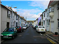
Lincoln Street
Head east up Southover Street then north into Lincoln Street. This area was developed from 1865-69 and the streets are named after American Civil War figures; Lincoln, Jackson and Grant. This is the Hanover district of Brighton of terraced workers houses which are popular but as can be seen, parking is a huge problem.
Click on the link to take you to the next page. http://www.geograph.org.uk/photo/231993
Image: © Simon Carey
Taken: 1 Sep 2006
0.04 miles
10
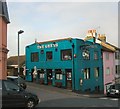
The Greys Pub, Southover St.
Website: http://www.greyspub.com/
Image: © Paul Gillett
Taken: 6 Nov 2011
0.05 miles