
IMAGES TAKEN NEAR TO
Greenbank Avenue, BRIGHTON, BN2 8QQ
Introduction
This page details the photographs taken nearby to Greenbank Avenue, BN2 8QQ by members of the Geograph project.
The Geograph project started in 2005 with the aim of publishing, organising and preserving representative images for every square kilometre of Great Britain, Ireland and the Isle of Man.

There are currently over 7.5m images from over14,400 individuals and you can help contribute to the project by visiting https://www.geograph.org.uk
Image Map
Images are licensed for reuse under creativecommons.org/licenses/by-sa/2.0
Notes
- Clicking on the map will re-center to the selected point.
- The higher the marker number, the further away the image location is from the centre of the postcode.
Image Listing (42 Images Found)
Images are licensed for reuse under creativecommons.org/licenses/by-sa/2.0
Image
Details
Distance
1
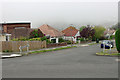
Arlington Gardens with sea mist
A bright sunny morning suddenly changed about midday (BST) as a sea mist swept in. Normally there would be a good view from here.
Image: © Robin Webster
Taken: 19 May 2010
0.05 miles
2
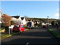
Heathfield Avenue, Saltdean
A residential road that runs from Hempstead Road to Greenbank Avenue that was completed by the outbreak of World War Two. Telscombe Tye is also in view.
Image: © Simon Carey
Taken: 28 Jan 2016
0.06 miles
3
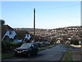
Mount Drive, Saltdean
A residential road that links Greenbank Avenue to Saltdean Vale. The northern side appears to have been developed by 1951 with the southern side added later that decade. Originally known as Saltdean Drive but renamed by the 1960s.
Image: © Simon Carey
Taken: 16 Jan 2016
0.08 miles
4
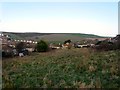
Undeveloped Plot, Greenbank Avenue, Saltdean
Located between Mount Drive and Berwick Road. One wonders how long this will stay as it is, it certainly doesn't appear to be used for anything. High Hill can be seen in the distance.
Image: © Simon Carey
Taken: 16 Jan 2016
0.10 miles
5
Glynde Avenue, Saltdean
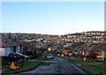
A residential road that runs between Greenbank Avenue and Saltdean Vale that was developed in the 1950s. Some early morning frost still remains on the road and somebody has made use of the grit in the bunker on the left.
Image: © Simon Carey
Taken: 16 Jan 2016
0.12 miles
6
Berwick Road, Saltdean
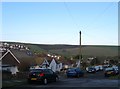
A short residential road that runs between Greenbank Avenue and Hempstead Road that was developed in the late 1940s.
Image: © Simon Carey
Taken: 16 Jan 2016
0.12 miles
7
Arlington Gardens, Saltdean
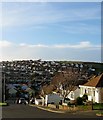
A residential road that runs between Greenbank Avenue and Saltdean Vale that was completed by the outbreak of World War Two. The road crosses Hempstead Road with the part in the picture the western section. Both that and the housing on the far hill are catching the late afternoon sun.
Image: © Simon Carey
Taken: 28 Jan 2016
0.12 miles
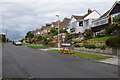
10
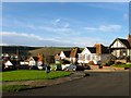
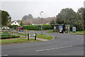
Hillgrove Road, Saltdean
A residential road that runs between Hempstead Road and Saltdean Vale that had been completed by the outbreak of World War Two. High Hill can be seen beyond.
Image: © Simon Carey
Taken: 28 Jan 2016
0.15 miles