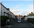
IMAGES TAKEN NEAR TO
Park Road, BRIGHTON, BN2 7JD

Introduction

This page details the photographs taken nearby to Park Road, BN2 7JD by members of the Geograph project.

The Geograph project started in 2005 with the aim of publishing, organising and preserving representative images for every square kilometre of Great Britain, Ireland and the Isle of Man.

There are currently over 7.5m images from over14,400 individuals and you can help contribute to the project by visiting https://www.geograph.org.uk

Image Map


Images are licensed for reuse under creativecommons.org/licenses/by-sa/2.0
Notes
  • Clicking on the map will re-center to the selected point.
  • The higher the marker number, the further away the image location is from the centre of the postcode.

Image Listing (312 Images Found)

Images are licensed for reuse under creativecommons.org/licenses/by-sa/2.0
  • ...
Image
Details
Distance
1
Park Road
Small side road that lies on the eastern slope of Beacon Hill as it descends towards the village of Rottingdean. The road links Marine Drive, the A259, with High Street, the B2123.
Image: © Simon Carey Taken: 6 Jan 2010
0.00 miles
2
Park Crescent, Rottingdean
A cul de sac off Image and the western arm of two that share the same name, see Image for the eastern part. Developed in the 1920s.
Image: © Simon Carey Taken: 31 Dec 2015
0.03 miles
3
Apartments on Marine Drive, Rottingdean
Image: © JThomas Taken: 6 Mar 2012
0.03 miles
4
The Cape, Marine Drive, Rottingdean
A block of flats built in 2003 on the site of a former house with an extensive garden. Viewed from Sheep Walk.
Image: © Simon Carey Taken: 31 Dec 2015
0.04 miles
5
Flats on Sheep Walk
Image: © Oast House Archive Taken: 10 Oct 2010
0.04 miles
6
Rottingdean, Marine Drive
Image: © David Dixon Taken: 5 Aug 2012
0.05 miles
7
Rottingdean, beach cabins
On Undercliff Walk.
Image: © Mike Faherty Taken: 20 Oct 2018
0.05 miles
8
Golden Square
Small square lying between West Street and Park Road. Formerly the site of four old cottages which lacking in modern utilities were pulled down in 1931 leaving only the former washroom standing, seen on the right at the end of the square. The area remained derelict for many years until the local council refurbished it and opened it up as a small public area. Not many are around on this day as snow can be seen to be falling, and although not heavy it remained persistent throughout the whole day.
Image: © Simon Carey Taken: 6 Jan 2010
0.05 miles
9
Park Road
Image: © Oast House Archive Taken: 21 Jul 2012
0.05 miles
10
Park Road, Rottingdean
A residential road that links Marine Drive to High Street that was developed intermittently from the 1920s onwards.
Image: © Simon Carey Taken: 31 Dec 2015
0.05 miles
  • ...