1
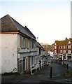
Marine Drive, Rottingdean
Image: © David Dixon
Taken: 5 Aug 2012
0.03 miles
2
St Aubyns Mead, Rottingdean
A cul de sac off
Image that was built in the early 1980s on the southern tip of
Image The block of flats is Kipling Court.
Image: © Simon Carey
Taken: 16 Jan 2016
0.03 miles
3
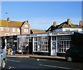
6-20, Marine Drive, Rottingdean
Built as a row of shops in the 1920s on the eastern side of the village crossroads. Some are still in use as shops and services whilst others have been converted into residential dwellings but retain the old shopfront.
Image: © Simon Carey
Taken: 16 Jan 2016
0.06 miles
4
Marine Cliffs Car Park, Rottingdean
A long stay, pay and display car park on the eastern side of the village centre that was laid out in the 1960s. Part of Highcliff Court is on the right.
Image: © Simon Carey
Taken: 16 Jan 2016
0.07 miles
5
PARC charity Shop, Rottingdean
Situated at the southern end of the High Street. PARC is a local children's charity which provides playgrounds and other recreational facilities for teenagers and children in Rottingdean, Ovingdean & Saltdean http://www.rottingdeanvillage.org.uk/charity-book-music-store-parc-charity-shop
Image: © Paul Gillett
Taken: 16 Dec 2012
0.07 miles
6
Lenham Road West, Rottingdean
Laid out in the early 1920s as part of the Rottingdean Heights estate, the road forms an eastern junction with
Image then crosses
Image before becoming a cul-de-sac.
Image: © Simon Carey
Taken: 28 Jan 2016
0.08 miles
7
St Margarets, Rottingdean
St Margarets are the block of flats to the left and can only date from the 1930s. The later ones on the right are called Highcliff Court.
Image: © Marathon
Taken: 18 Jul 2015
0.08 miles
8
St Margarets, High Street, Rottingdean
Image: © Robin Stott
Taken: 5 May 2018
0.08 miles
9
Cliff Top Hotel, Rottingdean
Image: © Paul Gillett
Taken: 26 Dec 2013
0.08 miles
10
Rottingdean, Coach House
Public house on High Street, on two floors. The ground floor has a beamed ceiling and partially exposed shingle walls; counter right, drinking and eating left; TV. Cask ale on offer: Harvey's Best.
Image: © Mike Faherty
Taken: 20 Oct 2018
0.08 miles


