IMAGES TAKEN NEAR TO
High Street, BRIGHTON, BN2 7HF

Introduction

This page details the photographs taken nearby to High Street, BN2 7HF by members of the Geograph project.

The Geograph project started in 2005 with the aim of publishing, organising and preserving representative images for every square kilometre of Great Britain, Ireland and the Isle of Man.

There are currently over 7.5m images from over14,400 individuals and you can help contribute to the project by visiting https://www.geograph.org.uk

Image Map


Images are licensed for reuse under creativecommons.org/licenses/by-sa/2.0
Notes
  • Clicking on the map will re-center to the selected point.
  • The higher the marker number, the further away the image location is from the centre of the postcode.

Image Listing (322 Images Found)

Images are licensed for reuse under creativecommons.org/licenses/by-sa/2.0
  • ...
Image
Details
Distance
1
Ye Olde Black Horse
Dated 1513 on front but much altered. Timber-frame, now rendered, roof of tiles. Grade II listed.
Image: © Keith Edkins Taken: 14 Sep 2018
0.02 miles
2
St Aubyns, High Street, Rottingdean
Built in the early 19th century as adwelling known as Field House it was converted into a school in 1832 becoming St Aubyns in 1895. It remained a private school until 2013 when, despite an offer from Hurstpierpoint College to take it over, its trustees closed the establishment citing dwindling numbers and difficulties recruiting a new headmaster. A couple of years later and the premises is still empty though it appears there are plans to convert it into apartments, however, locals are more concerned with the playing field to the rear being developed for housing.
Image: © Simon Carey Taken: 28 Dec 2015
0.02 miles
3
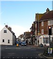
High Street
Looking from the junction with Park Road back down towards the junction with the A259. The tall, thin building beyond Denes Motors is Tallboys Cottage or the Old Custom House whose past retail business was the inspiration for the 'local shop' in The League of Gentlemen television show.
Image: © Simon Carey Taken: 6 Jan 2010
0.03 miles
4
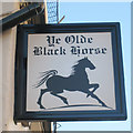
Ye Olde Black Horse sign
Image: © Oast House Archive Taken: 10 Oct 2010
0.03 miles
5
Ye Olde Black Horse, High Street
The oldest pub in Rottingdean dating back to 1513 and formerly known as the Black Hole, the lounge bar was once the village forge.
Image: © Simon Carey Taken: 6 Jan 2010
0.04 miles
6
Ye Olde Black Horse Public House, Rottingdean
High Street Rottingdean
Image: © David Eldridge Taken: 28 Aug 2006
0.04 miles
7
Ye Olde Black Horse
A public house along the High Street of Rottingdean, it is believed to be the oldest entire building in Rottingdean, having been built as early as 1513.
Image: © Mat Fascione Taken: 23 Aug 2022
0.05 miles
8
Shops on Nevill Road
Shops and cafés at the lower end of Nevill Road near to High Street.
Image: © Oast House Archive Taken: 10 Oct 2010
0.05 miles
9
High Street, Rottingdean
The B2123 viewed from the crossroads with Marine Drive, the A259. As can be seen the road is a busy one being one of three access points for the suburb of Woodingdean.
Image: © Simon Carey Taken: 28 Dec 2015
0.05 miles
10
Nevill Road
A row of shops on the right and sorting office on left leading onto hill with a private road and public footpath.
Image: © Oast House Archive Taken: 10 Oct 2010
0.05 miles
  • ...