
IMAGES TAKEN NEAR TO
Newlands Road, BRIGHTON, BN2 7GD
Introduction
This page details the photographs taken nearby to Newlands Road, BN2 7GD by members of the Geograph project.
The Geograph project started in 2005 with the aim of publishing, organising and preserving representative images for every square kilometre of Great Britain, Ireland and the Isle of Man.

There are currently over 7.5m images from over14,400 individuals and you can help contribute to the project by visiting https://www.geograph.org.uk
Image Map
Images are licensed for reuse under creativecommons.org/licenses/by-sa/2.0
Notes
- Clicking on the map will re-center to the selected point.
- The higher the marker number, the further away the image location is from the centre of the postcode.
Image Listing (190 Images Found)
Images are licensed for reuse under creativecommons.org/licenses/by-sa/2.0
Image
Details
Distance
1
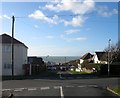
Lenham Road West, Rottingdean
Laid out in the early 1920s as part of the Rottingdean Heights estate, the road forms an eastern junction with Image then crosses Image before becoming a cul-de-sac.
Image: © Simon Carey
Taken: 28 Jan 2016
0.05 miles
2
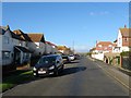
Chailey Avenue, Rottingdean
Laid out in the early 1920s as part of the Rottingdean Heights estate and initially ran just beyond the junction with Knoll Road. It was extended northwards to Whiteway Lane in the late 1950s which also provided an eastern junction with Steyning Road thus creating a convenient rat run for vehicles wishing to avoid the traffic lights at Rottingdean crossroads.
Image: © Simon Carey
Taken: 28 Jan 2016
0.05 miles
4
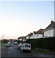
Newlands Road, Rottingdean
A residential road that links marine Drive, the A259, with Steyning Road that was developed in the 1920s. The houses on the right look out over Image
Image: © Simon Carey
Taken: 16 Jan 2016
0.07 miles
5
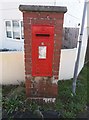
Rottingdean: postbox № BN2 171
A GR cipher pillar/wall box in Rottingdean, W.Sx.
Image: © mcc
Taken: 28 Dec 2017
0.08 miles
6
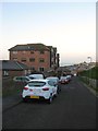
St Aubyns Mead, Rottingdean
A cul de sac off Image that was built in the early 1980s on the southern tip of Image The block of flats is Kipling Court.
Image: © Simon Carey
Taken: 16 Jan 2016
0.08 miles
9
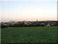
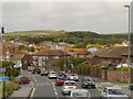
St Aubyns Playing Field, Rottingdean
Viewed from Image at sunrise with Image on the horizon. On Rottingdean's 1839 tithe map this was an extensive field called Vicarage Laine which became the main playing field of St Aubyns School, see Image, after the First World War. The southern tip adjacent to the A259 was sold off in the early 1980s and developed into Image With the final closure of the school in 2013 there has since been a battle to prevent further development which is still ongoing. Most locals wish to retain the open field for public use. The former tennis courts are to the left whilst to the right is the cricket pavilion. To the left of the windmill the road is Image whilst the large block of flats is Image
Image: © Simon Carey
Taken: 16 Jan 2016
0.10 miles
10
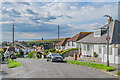
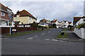
Knole Road
c.1920s housing in Knole Road. In the background is Rottingdean Windmill on Beacon Hill.
Image: © Ian Capper
Taken: 20 Sep 2022
0.10 miles